Near Beaver Bay in Lake County, Minnesota — The American Midwest (Upper Plains)
Geology of Minnesota
Split Rock Region
Photographed by Jenn Wintermantel, August 12, 2014
1. Geology of Minnesota Marker
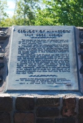
The scenery of the region between Split Rock and Beaver Bay is the direct result of important events of early geologic time.
Lava flows, which had accumulated in this region to a thickness of about 30,000 feet, were lifted and arched by a huge mass of molten material rising through the earth's crust farther north. This mass, this Duluth Gabbro, is now extensively exposed in the Duluth area.
The lighthouse cliff standing 100 feet high is a fine-grained phase of Gabbro named Beaver Bay diabase. The massive resistant character of which makes the shore of this region particularly bold and rocky.
At the base of the lighthouse on top of the cliff is another kind of rock, light green in color and coarse in texture, called Anorthosite. It is this rock, Anorthosite, which shows an excellent exposure in the highway cut at Silver Bay and stands up as prominent rounded hills from Split Rock to Carlton Peak near Tofte.
Erected 1955 by Geological Society of Minnesota and the Department of Highways, State of Minnesota.
Topics and series. This historical marker is listed in this topic list: Natural Features. In addition, it is included in the Minnesota: Geological Society of Minnesota series list.
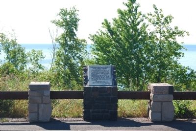
Location. 47° 11.957′ N, 91° 22.779′ W. Marker is near Beaver Bay, Minnesota, in Lake County. It can be reached from State Highway 61 3 miles north of Blueberry Hill Road. Located in a Wayside just south of Split Rock Lighthouse. Touch for map. Marker is in this post office area: Two Harbors MN 55616, United States of America. Touch for directions.

Regionally, this marker is in the Arrowhead Region, in the Iron Range, and in the North Shore. It is also in the American Midwest and in the Corn Belt. Globally, it is in North America, in the Great North Woods,
this page online
Other nearby markers. At least 8 other markers are within walking distance of this marker: View of the Lighthouse (a few steps from this marker); Dock Site and Pumphouse (approx. 0.4 miles away); A Split Rock Mystery... (approx. half a mile away); Tramway (approx. half a mile away); Little Two Harbors (approx. 0.6 miles away); Storage Barn (approx. 0.6 miles away); Home Away From Home (approx. 0.6 miles away); Fog Signal (approx. 0.6 miles away). Touch for a list and map of all markers in Beaver Bay.
Photographed by Jenn Wintermantel, August 12, 2014
2. Geology of Minnesota Marker
Credits. This page was last revised on August 12, 2026. It was originally submitted on August 15, 2014, by Mike Wintermantel of Pittsburgh, Pennsylvania. This page has been viewed 932 times since then and 44 times this year. Photos: 1, 2. submitted on August 15, 2014, by Mike Wintermantel of Pittsburgh, Pennsylvania.
