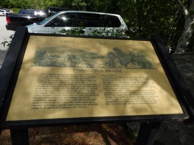
Franconia Range
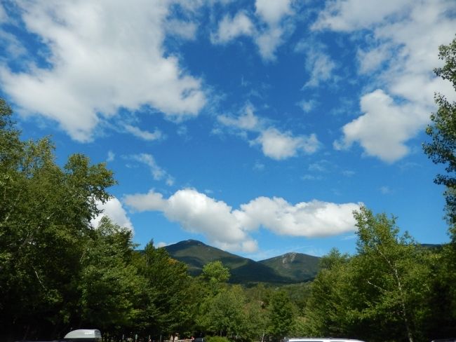
The mountains you are looking at are part of the Franconia Range and like the rest of the White Mountains are among the oldest in the world. They date back to a period in geological time more than 400 million years ago when this area was covered by an inland sea.
In the millions of years that followed, the sea drew back from the land and sedimentary rocks were exposed. Great compressional forces creating heat and pressure, cuased physical and chemical changes to take place. This was followed by molten rock being thrust upward from deep within the earth. Erosion then removed many thousands of feet of metamorphic rock and exposed the granite underneath, leaving a low rolling plain with an elevation close to that of sea level. Some 60 million years ago a regional uplift began and the land surface was gradually raised to an elevation of between four and five thousand feet.
More than two million years ago, the great Ice Age reached this area and ice accumulated until these peaks were buried with ice up to a mile in thickness. As the Ice Age drew to a close, between 25,000 and 8,000 years ago, the old ice melted leaving the land much as you see it today. Since then weathering and erosion is again taking place as a geological force.
From these peaks, melting snows and summer rains cascade down the steep mountain sides helping
to form the Pemigewasset River that drains Franconia Notch. Several miles of popular hiking trails lead up and across the Franconia Range, including the 2035 mile long Appalachian trail, a foot path that connects Springer Mountain in Georgia with Mount Katahdin in Maine.Topics. This historical marker is listed in these topic lists: Environment • Natural Features. A significant historical year for this entry is 2035.
Location. 44° 5.797′ N, 71° 40.881′ W. Marker is in Franconia, New Hampshire, in Grafton County. Marker can be reached from U.S. 3. Marker is in Franconia Notch State Park. Touch for map. Marker is in this post office area: Franconia NH 03580, United States of America. Touch for directions.
Other nearby markers. At least 8 other markers are within 4 miles of this marker, measured as the crow flies. A Bit of History (within shouting distance of this marker); Franconia Notch State Park (about 300 feet away, measured in a direct line); Eastern Brook Trout (about 300 feet away); The Flume (about 400 feet away); a different marker also named The Flume (about 600 feet away); Betty and Barney Hill Incident (approx. 0.8 miles away); Clark's Bridge (approx. 3.2 miles away); Quinten E. Mulleavey (approx. 3.2 miles away). Touch for a list and map of all markers in Franconia.
Credits. This page was last revised on June 16, 2016. It was originally submitted on August 21, 2014, by Bill Pfingsten of Bel Air, Maryland. This page has been viewed 446 times since then and 15 times this year. Photos: 1, 2. submitted on August 21, 2014, by Bill Pfingsten of Bel Air, Maryland.

