
Santa Fe in Santa Fe County, New Mexico — The American Mountains (Southwest)
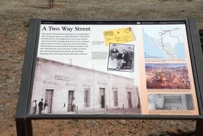
A Two Way Street
Amelia White Park
| — | Santa Fe National Historic Trail | — |
Photographed by J. J. Prats, April 23, 2014
1. A Two Way Street Marker
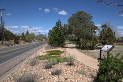
The Santa Fe Trail passed through what is now Amelia White Park. The paved road to the right, Old Santa Fe Trail, follows the path and ruts of the original trail route, whose travelers came from a variety of backgrounds. From the start, Hispanic traders made use of this two way street. From New Mexico, they traveled over the Santa Fe Trail, just as others came west. Traveling to St. Louis, New York, London, Paris, they sold raw goods from New Mexico, and purchased finished goods to sell in Santa Fe and other parts of Mexico.
Erected by Santa Fe Trail Association, Old Santa Fe Trail Neighborhood Association, and the City of Santa Fe.
Topics and series. This historical marker is listed in these topic lists: Colonial Era • Roads & Vehicles. In addition, it is included in the Santa Fe Trail series list.
Location. 35° 40.353′ N, 105° 55.901′ W. Marker is in Santa Fe, New Mexico, in Santa Fe County. It is on Old Santa Fe Trail (Old U.S. 66) west of Camino Corrales, on the left when traveling east. Touch for map. Marker is in this post office area: Santa Fe NM 87505,
this page online

Regionally, this marker is in Northern New Mexico. It is also in the American Southwest, in the Mountain West, and on the Santa Fe Trail Corridor. Globally, it is in North America, the Rocky Mountains, the Western Hemisphere, the Western World, and the Anglosphere. Historically, it finds itself in what was once New Spain and also the Republic of Texas.
Other nearby markers. At least 8 other markers are within walking distance of this marker: Santa Fe Korean War Memorial (within shouting distance of this marker); Journey's End (approx. half a mile away); Santa Fe Trail - Road to Opportunity (approx. half a mile away); Kearny's Gap Bridge (approx. half a mile away); Trade Transforms Art (approx. 0.6 miles away); The Artist's Garden (approx. 0.6 miles away); Mexican Colonial House (approx. 0.6 miles away); National Park Service Southwest Regional Office (approx. 0.6 miles away). Touch for a list and map of all markers in Santa Fe.
Also see . . . Santa Fe Trail. Wikipedia entry (Submitted on November 11, 2023, by Larry Gertner of New York, New York.)
Photographed by J. J. Prats, April 23, 2014
2. The Marker Faces Old Santa Fe Trail
Credits. This page was last revised on November 11, 2023. It was originally submitted on August 23, 2014, by J. J. Prats of Powell, Ohio. This page has been viewed 865 times since then and 22 times this year. Photos: 1. submitted on August 23, 2014, by J. J. Prats of Powell, Ohio. 2. submitted on August 24, 2014, by J. J. Prats of Powell, Ohio.
