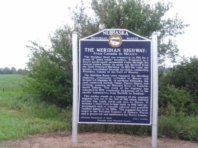
South Branch in Pierce County, Nebraska — The American Midwest (Upper Plains)
The Meridian Highway: From Canada to Mexico
The Meridian Road, later renamed the Meridian Highway, eventually extended to Mexico and became U.S. Highway 81. In northern Nebraska, the road connected Norfolk, Hadar, Pierce, Wausa, and Crofton, crossing the Missouri River at Yankton, South Dakota. The route of the highway was relocated in 1939, eventually bypassing all of the smaller communities from Norfolk to Yankton.
This marker stands on a segment of the original highway laid out in the fall of 1911, which followed section line roads north and west to Pierce. It includes a steel truss bridge built in 1915 and improvements such a concrete culverts and graveled roadbed dating to the 1920s. This segment has been listed in the National Register of Historic Places and is preserved and maintained by Pierce County.
Erected by Nebraska Department of Roads; Pierce County; Nebraska State Historical Society. (Marker Number 434.)
Topics and series. This historical marker is listed in this topic list: Roads & Vehicles. In addition, it is included in the Nebraska State Historical Society series list. A significant historical year for this entry is 1911.
Location. 42° 9.164′ N, 97° 29.105′ W. Marker is in South Branch, Nebraska, in Pierce County. Marker is at the intersection of State Highway 13 and 552nd Avenue, on the left when traveling east on State Highway 13. 4 miles southeast of Pierce. Touch for map. Marker is in this post office area: Pierce NE 68767, United States of America. Touch for directions.
Other nearby markers. At least 6 other markers are within 13 miles of this marker, measured as the crow flies. Old Willow Creek Bridge (approx. 3.8 miles away); Gilman Park (approx. 3.8 miles away); St. Paul's Lutheran Church (approx. 8.2 miles away); Verges Park (approx. 8.7 miles away); Battle Creek (approx. 11.6 miles away); The Skala Timber House (approx. 12.6 miles away).
Credits. This page was last revised on June 16, 2016. It was originally submitted on August 31, 2014, by Joan Shurtliff of Seward, Nebraska. This page has been viewed 848 times since then and 46 times this year. Photo 1. submitted on August 31, 2014, by Joan Shurtliff of Seward, Nebraska. • Bill Pfingsten was the editor who published this page.
