Victoria Boulevard Historic District in Hampton, Virginia — The American South (Mid-Atlantic)
Seventeenth-Century Hampton
Rough Beginning
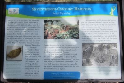
It began as a brief encounter. The Jamestown-bound English settlers landed at Strawberry Banks on April 30, 1607 and, after a wary first reception by native villagers, ended up breaking bread and smoking tobacco with them. During a stormy Christmas week the following year, Captain John Smith and his crew got a royal reception. As he put it, We were never more merry, nor fed on more plenty of good oysters, fish flesh, wild fowl, and good bread, nor never had better fires in England than in the dry, warm, smoky houses of Kecoughtan.
Relations between the whites and Indians quickly soured. In the fall of 1609, the English built Fort Algernourne at Point Comfort. The following July, they attacked Kecoughtan, killing several of the inhabitants, driving out the rest, taking over their cultivated fields and erecting forts near the entrance of Hampton River. It was a rough beginning for what was to become the oldest, continuously inhabited English settlement in America.
In 1619, the General Assembly changed the name from Kecoughtan to Elizabeth City, honoring the daughter of King James. That same year, about 20 Africans were landed here. They were likely treated as indentured servants, but the tobacco-based economy soon caused the legal shackles of slavery to tighten.
Elizabeth City quickly became the leading port and population center in Virginia. All merchant ships were required to stop and pay customs duties. A tobacco inspection warehouse was a fixture on the waterfront. Captains, seamen, and shipwrights crowded the docks and populated taverns and rooming houses. In 1691, a town was laid out and half-acre lots sold. In 1706, almost a century from that first arrival, the town’s name was officially changed to Hampton.
[Captions:]
North Devon sgraffito slipware plate, inscribed “1668.” This plate fragment was unearthed during archaeological excavations of the trading plantation of Thomas Jarvis, who was a ship captain, merchant, and tobacco planter. The plantation was located near today’s intersection of King Street and Pembroke Avenue. – Courtesy of the Hampton History Museum
Tobacco Production, painted by Sidney King for the 350th anniversary of the settlement at Jamestown. – Courtesy of National Park Service, Colonial National Historical Park
Detail from “The Towne of Pomeiooc,” an engraving by Theodore de Bry, based on watercolor paintings by John White depicting Native inhabitants near the failed English colony at Roanoke. The inhabitants of this village shared many cultural ties to the Native groups of the Chesapeake region, and the village of Kecoughtan probably appeared quire similar to those seen by the English part landing at Strawberry Banks. – Courtesy of the Hampton History Museum
Erected 2010.
Topics. This historical marker is listed in these topic lists: Colonial Era • Exploration • Native Americans • Settlements & Settlers. A significant historical date for this entry is April 30, 1607.
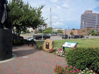
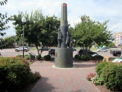
Location. 37° 1.473′ N, 76° 20.607′ W. Marker is in Hampton, Virginia. It is in the Victoria Boulevard Historic District. Marker is at the intersection of Settlers Landing Road (U.S. 60) and South King Street, on the left when traveling west on Settlers Landing Road. Touch for map. Marker is at or near this postal address: 602 Settlers Landing Road, Hampton VA 23669, United States of America. Touch for directions.
Other nearby markers. At least 8 other markers are within walking distance of this marker. Eighteenth-Century Hampton (here, next to this marker); Twentieth-Century Hampton (here, next to this marker); Ninteenth-Century Hampton (a few steps from this marker); Langley Field: Creating an Air Force (a few steps from this marker); Langley Field: Discovering Aerospace (a few steps from this marker); Hampton (within shouting distance of this marker); Dr. Katherine G. Johnson (within shouting distance of this marker); British Approach to Hampton / The War of 1812 (within shouting distance of this marker). Touch for a list and map of all markers in Hampton.
Also see . . . This is Hampton, Virginia. Hampton Convention & Visitor Bureau (Submitted on September 2, 2014.)
Credits. This page was last revised on February 1, 2023. It was originally submitted on September 2, 2014, by Bernard Fisher of Richmond, Virginia. This page has been viewed 836 times since then and 39 times this year. Photos: 1, 2, 3. submitted on September 2, 2014, by Bernard Fisher of Richmond, Virginia.


