
Columbus in Colorado County, Texas — The American South (West South Central)
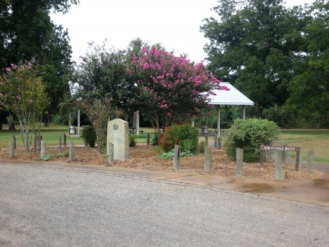
Benjamin Beason's Crossing
of the Colorado River

Photographed by Jim Evans, September 1, 2014
1. Benjamin Beason's Crossing Marker
Benjamin Beeson at WikiTree:
Click for more information.
Click for more information.
March 19-26, 1836
of the Texas Army
under General Sam Houston,
who directed the retreat
from Gonzales to the San Jacinto
Erected 1936 by State of Texas. (Marker Number 368.)
Topics and series. This historical marker is listed in these topic lists: War, Texas Independence • Waterways & Vessels. In addition, it is included in the Texas 1936 Centennial Markers and Monuments series list. A significant historical month for this entry is March 1813.
Location. 29° 42.253′ N, 96° 32.117′ W. Marker is in Columbus, Texas, in Colorado County. It can be reached from Walnut Street (U.S. 90) 0.2 miles west of Old U.S. 90, on the left when traveling west. Located in Beason's Park. Touch for map. Marker is at or near this postal address: 3614 US 90, Columbus TX 78934, United States of America. Touch for directions.

Regionally, this marker is in the American South and on the Gulf Coast. Globally, it is in North America, a Gulf of Mexico state, the Western Hemisphere, the Western World, and the Anglosphere. Historically, it finds itself in what was once New Spain, the Republic of Texas, one of the Confederate States of America, and the Antebellum South.
Other nearby markers. At least 8 other markers are within walking distance of this marker: Beason's (Beeson's) Crossing (a few steps from this marker); Columbus Waterworks (approx. 0.2 miles away); Townsend-Koliba House (approx. 0.2 miles away); Stage Lines Through Columbus (approx. ¼ mile away); Asa Townsend (approx. ¼ mile away); Joseph V. Frnka (approx. ¼ mile away); Early Site of Doctor Logue's Drugstore (approx. ¼ mile away); District Court Tree (approx. ¼ mile away). Touch for a list and map of all markers in Columbus.
Also see . . . Some History of Beason's Crossing. (Submitted on September 2, 2014, by Jim Evans of Houston, Texas.)
this page online
Photographed by Jim Evans, September 1, 2014
2. Benjamin Beason's Crossing Marker
Credits. This page was last revised on November 8, 2025. It was originally submitted on September 2, 2014, by Jim Evans of Houston, Texas. This page has been viewed 3,373 times since then and 99 times this year. Photos: 1, 2. submitted on September 2, 2014, by Jim Evans of Houston, Texas. • Bernard Fisher was the editor who published this page.
