Plymouth in Washington County, North Carolina — The American South (South Atlantic)
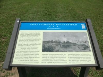
Fort Compher Battlefield
The Breakthrough
On April 19, Ransom positioned his brigade east of Fort Compher, which was defended by elements of the 101st Pennsylvania, 16th Connecticut, and 85th New York Infantry, as well as the 2nd Massachusetts Heavy Artillery. Ransom’s men constructed pontoon bridges across Conaby Creek near present-day Riverside Baptist Church on East Main Street.
At dawn the next day, several thousand Confederates charged across the field to the fort. A newspaper correspondent compared it to “the wildest gust of tornado as it prostrates the forest, or the mad fire as it dashes through the prairies, it was a thunderbolt.” The Union defenders threw grenades at the Confederates swarming the ditch and scrambling up the embankments. Some of the attackers assaulted the stockade, where Union and Confederate soldiers took turns firing at each other through gunports in the stockade walls. Soon the fort fell, and the Confederates swept past into town. At midmorning, Union Gen. William H Wessells surrendered Plymouth.
Erected by North Carolina Civil War Trails.
Topics and series. This historical marker is listed in these topic lists: Forts and Castles • War, US Civil. In addition, it is included in the North Carolina Civil War Trails series list. A significant historical month for this entry is April 1864.
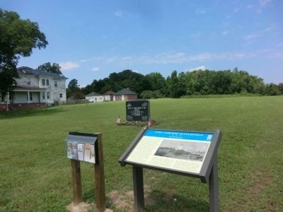
Location. 35° 52.134′ N, 76° 44.514′ W. Marker is in Plymouth, North Carolina, in Washington County. Marker is at the intersection of East Main Street and Rankin Lane, on the right when traveling west on East Main Street. Touch for map. Marker is in this post office area: Plymouth NC 27962, United States of America. Touch for directions.
Other nearby markers. At least 8 other markers are within walking distance of this marker. Battle of Plymouth Memorial (within shouting distance of this marker); Naval Action (approx. 0.2 miles away); Latham House (approx. 0.3 miles away); Battle of Plymouth (approx. 0.3 miles away); Replica 6.4 inch Brooke Rifled Cannon (approx. 0.3 miles away); New Chapel Baptist Church (approx. 0.3 miles away); Carthagenia Lodge (approx. 0.3 miles away); Plymouth State Normal School (approx. 0.3 miles away). Touch for a list and map of all markers in Plymouth.
Credits. This page was last revised on June 16, 2016. It was originally submitted on September 2, 2014, by Don Morfe of Baltimore, Maryland. This page has been viewed 1,127 times since then and 39 times this year. Photos: 1, 2. submitted on September 2, 2014, by Don Morfe of Baltimore, Maryland. • Bernard Fisher was the editor who published this page.
Editor’s want-list for this marker. Photos of the nearby fort. • Can you help?

