Hope Village in Portsmouth, Virginia — The American South (Mid-Atlantic)
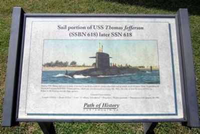
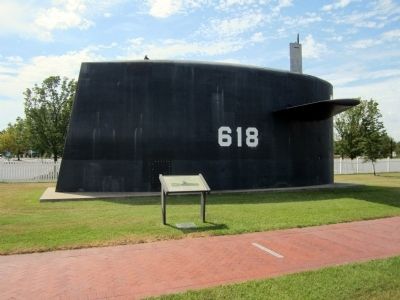
Sail portion of the USS Thomas Jefferson
(SSBN 618) later SSN 618
— Path of History Portsmouth, VA —
Inscription.
During USS Thomas Jefferson's 22 years of service, it was both a ballistic missile submarine and an attack vessel. Newport News Shipbuilding & Drydock Company built USS Thomas Jefferson, which was commissioned on January 4th, 1963. The wife of then Secretary of Defense, Robert S. McNamara, was the ship's sponsor.
Length: 410 Feet • Beam: 33 feet • Crew: 12 officers, 128 enlisted • Propulsion: Nuclear powered • Decommissioned: January 24, 1985
Topics. This historical marker is listed in these topic lists: Industry & Commerce • War, Cold • Waterways & Vessels. A significant historical month for this entry is January 2012.
Location. 36° 49.687′ N, 76° 17.839′ W. Marker is in Portsmouth, Virginia. It is in Hope Village. Marker can be reached from Lincoln Street east of 3rd Street, on the left when traveling east. Located in Gosport Park. Touch for map. Marker is in this post office area: Portsmouth VA 23704, United States of America. Touch for directions.
Other nearby markers. At least 8 other markers are within walking distance of this marker. Norfolk Naval Shipyard (a few steps from this marker); a different marker also named Norfolk Naval Shipyard (a few steps from this marker); a different marker also named Norfolk Naval Shipyard (within shouting distance of this marker); a different marker also named Norfolk Naval Shipyard (within shouting distance of this marker); a different marker also named Norfolk Naval Shipyard (within shouting distance of this marker); a different marker also named Norfolk Naval Shipyard (within shouting distance of this marker); a different marker also named Norfolk Naval Shipyard (within shouting distance of this marker); a different marker also named Norfolk Naval Shipyard (within shouting distance of this marker). Touch for a list and map of all markers in Portsmouth.
Additional keywords. Sail portion of the USS Thomas Jefferson
Credits. This page was last revised on October 27, 2023. It was originally submitted on September 2, 2014, by Bernard Fisher of Richmond, Virginia. This page has been viewed 859 times since then and 54 times this year. Photos: 1, 2. submitted on September 2, 2014, by Bernard Fisher of Richmond, Virginia.

