Lockport in Niagara County, New York — The American Northeast (Mid-Atlantic)
Lower Lock Construction
Photographed by Barry Swackhamer, June 2, 2014
1. Lower Lock Construction Marker
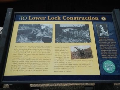
Construction of the locks began in 1910 under Contract 67 which included widening and deeming of the canal prism, construction of a hydraulic flume and erection of the Main and Transit Street bridges. The locks, canal prism and adjoining structures were constructed by the firm of Larkin and Sangster. Work began in October of 1910. In 1911 the entire south tier of the enlarged combined locks was demolished. The north tier was left open to maintain traffic while the new locks were being built. Rock walls were sliced away by compressed air channeling machines. The escarpment face was shattered by dynamite. Rock was excavated by a 70 ton Bucyrus steam shovel and hauled away by three “dinky trains”
this page online
In 1912 and 1913 the concrete lock walls were poured, and the lock machinery was installed. By January of 1914 Contract 67 was completed at a price of $1,048,772.
Sidebar on the right
Theodore Roosevelt (1858-1919) was the 26th President of the United States. As Governor of New York State he championed the enlargement of the Erie Canal. Today the Erie Barge Canal System is a tribute to his determination to revitalize the canal. Roosevelt also played an instrumental role in the development of the Panama Canal, which was built during his presidency.
Erected by New York State Canals. (Marker Number 10.)
Topics and series. This historical marker is listed in these topic lists: Industry & Commerce • Waterways & Vessels. In addition, it is included in the Erie Canal, and the Former U.S. Presidents: #26 Theodore Roosevelt series lists. A significant historical month for this entry is January 1914.
Location. 43° 10.217′ N, 78° 41.625′ W. Marker is in Lockport, New York, in Niagara County.
Photographed by Barry Swackhamer, June 2, 2014
2. Lower Lock Construction Marker
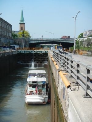
The marker is on the railing next to the lock.

Regionally, this marker is in Upstate New York, specifically in Western New York, and in the Buffalo Metropolitan Area. It is also in the American Northeast and in the Mid-Atlantic. Globally, it is in North America, on the Great Lakes, in the Western Hemisphere, in the Western World, and in the Anglosphere. Historically, it finds itself in what was once the Viceroyalty of New France, the Haudenosaunee (Iroquois) Confederacy, New Netherland, and one of the original Thirteen Colonies.
Other nearby markers. At least 8 other markers are within walking distance of this marker: Tour Boat Then & Now (here, next to this marker); Upson Park (a few steps from this marker); Hydraulic Race Control Gates (within shouting distance of this marker); “Lockport Flight of Five” (within shouting distance of this marker); Lock 71 Forebay (within shouting distance of this marker); Harrison Radiator Company (within shouting distance of this marker); Canal Street (within shouting distance of this marker); The Ralph C. Wilson, Jr. Gateway (within shouting distance of this marker). Touch for a list and map of all markers in Lockport.
Credits. This page was last revised on June 16, 2016. It was originally submitted on September 6, 2014, by Barry Swackhamer of Brentwood, California. This page has been viewed 628 times since then and 26 times this year. Photos: 1, 2. submitted on September 6, 2014, by Barry Swackhamer of Brentwood, California. • Bill Pfingsten was the editor who published this page.
