Saint-Jean in Le Haut-Richelieu, Québec — Central Canada (French-Canadian)
Fort Saint-Jean
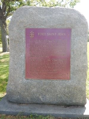
Photographed by Kevin Craft, September 7, 2014
1. Fort Saint-Jean Marker
{French text}
L'état de guerre avec les Iroquois incita les Français à bâtir un fort à Saint-Jean en 1666. Un nouveau fort fut érigé en 1748 afin de protéger la colonie française contre les expéditions militaires britanniques qui remontaient la rivière Richelieu. En 1775, deux redoutes furent construites pour défendre contre l'invasion américaine la colonie passée aux mains des Anglais. La même année, le fort soutint un siège de 45 jours dirigé par le général américain Montgomery. A la suite du soulèvement de 1837, de nouvelles fortifications furent établies sur l'emplacement du fort. Ces bâtiments constituent depuis 1952 le coeur du Collège militaire royal de Saint-Jean.
{English text}
As a result of the Iroquois wars a first fort was erected at St-Jean by the French in 1666. In 1748 a second fort was built to protect the French colony against British military expeditions coming up the Richelieu. Later on, as a result of the American Revolution, two redoubts were built to protect the now English colony against an American invasion. Following the 1837 uprising a new military complex was built on the site of its predecessors.
this page online
Erected by Historic Sites and Monuments Board of Canada.
Topics and series. This historical marker is listed in these topic lists: Forts and Castles • War, US Revolutionary • Waterways & Vessels. In addition, it is included in the Canada, Historic Sites and Monuments Board series list. A significant historical year for this entry is 1666.
Location. 45° 17.926′ N, 73° 15.207′ W. Marker is in Saint-Jean, Québec, in Le Haut-Richelieu. It can be reached from Jacques-Cartier Street North half a kilometer north of Vanier Street. Touch for map. Marker is at or near this postal address: 15 Jacques-Cartier Street North, Saint-Jean QC J3B 8R8, Canada. Touch for directions.

Regionally, this marker is in Greater Montréal. It is also in Central Canada. Globally, it is in North America, the Western Hemisphere, and the Western World. Historically, it finds itself in what was once a British colony, the Viceroyalty of New France, the Haudenosaunee (Iroquois) Confederacy, and Rupert’s Land.
Other nearby markers. At
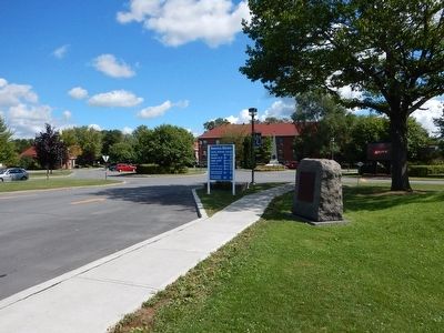
Photographed by Kevin Craft, September 7, 2014
2. Wideview of Fort Saint-Jean Marker
More about this marker. The marker is located just inside the main gates of the Royal Military College Saint-Jean. The campus of the Military College is park-like along the river and is open to the public.
Also see . . . Fort Saint-Jean National Historic Site of Canada. Historic Places Canada page for Fort Saint-Jean: ...Fort Saint-Jean National Historic Site of Canada is located on the Richelieu River, about 40 kilometres southeast of Montréal, in Saint-Jean-sur-Richelieu, Québec. Built in the 18th century, remains of the early fort ramparts include the masonry foundations, piling impressions, and stockade trenches. Remains of the 1776 fort can also be seen on the site today, particularly the two bastions. Official recognition refers to the footprint of the forts built in 1748 and 1775–1776. (Submitted on September 24, 2014.)
Credits. This page was last revised on June 16, 2016. It was originally submitted on September 9, 2014, by Kevin Craft of Bedford, Quebec. This page has been viewed 680 times since then and 36 times this year. Photos: 1, 2. submitted on September 9, 2014, by Kevin Craft of Bedford, Quebec. • Andrew Ruppenstein was the editor who published this page.
