Voorheesville in Albany County, New York — The American Northeast (Mid-Atlantic)
Thacher Point
Photographed by Howard C. Ohlhous, September 14, 2014
1. Thacher Point Marker
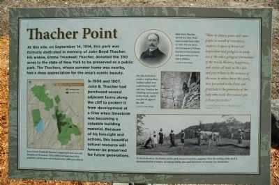
In 1906 and 1907, John B. Thacher had purchased several adjacent farms along the cliff to protect it from development at a time when limestone was becoming a valuable building material. Because of his foresight and actions, this beautiful natural resource will forever be preserved for future generations.
"Here in future years will come people in search of recreation; students in quest of historical inspiration and geologists to study one of the oldest geological formations of the world. History, happiness, and science all meet on this spot and pay tribute to the memory of the man in whose honor this park was presented to the State and gratitude to the generosity of the lady who made this valued spot a State possession." - Governor Martin Glynn, Dedication Speech, September 14, 1914.
Erected 2014 by New York
this page online
Topics. This historical marker is listed in these topic lists: Charity & Public Work • Environment • Paleontology. A significant historical date for this entry is September 14, 1914.
Location. 42° 39.314′ N, 74° 0.972′ W. Marker is in Voorheesville, New York, in Albany County. It can be reached from Thacher Park Road. Marker is located at Thacher Point. Touch for map. Marker is in this post office area: Voorheesville NY 12186, United States of America. Touch for directions.

Regionally, this marker is in Upstate New York, in the Capital District, and in the Albany Metropolitan Area. It is also in the American Northeast and in the Mid-Atlantic. Globally, it is in North America, the Western Hemisphere, the Western World, and the Anglosphere. Historically, it finds itself in what was once New Netherland and also one of the original Thirteen Colonies.
Other nearby markers. At least 8 other markers are within 2 miles of this marker, measured as the crow flies: Tory Cave 1777 (within shouting distance of this marker); Indian Ladder (within shouting distance of this marker); Pioneer Geologists (about 300 feet away, measured
Photographed by Howard C. Ohlhous, September 14, 2014
2. Thacher Point Marker Detail
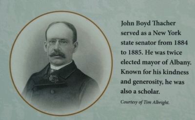
John Boyd Thacher served as a New York state senator from 1884 to 1885. He was twice elected mayor of Albany. Known for his kindness and generosity, he was also a scholar.
Additional keywords. Thacher Park, Verplanck Colvin
Photographed by Howard C. Ohlhous, September 14, 2014
3. Thacher Point Marker Detail
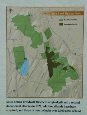
Since Emma Treadwell Thacher's original gift and a second donation of 50 acres in 1920, additional lands have been acquired, and the park now includes over 2,000 acres of land.
Photographed by Howard C. Ohlhous, September 14, 2014
4. Thacher Point Marker Detail
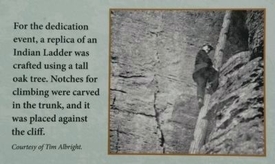
For the dedication event, a replica of an Indian Ladder was crafted using a tall oak tree. Notches for climbing were carved in the trunk, and it was placed against the cliff.
Photographed by Howard C. Ohlhous, September 14, 2014
5. Thacher Point Marker Detail
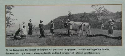
At the dedication, the history of the park was portrayed in a pageant. Here the settling of the land is demonstrated by a hunter, a farming family, and land surveyors of Patroon Van Rensselaer.
Photographed by Howard C. Ohlhous, September 13, 2014
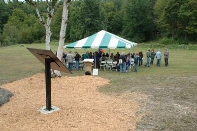
6. Thacher Park Centennial
The Centennial Celebration of John Boyd Thacher State Park was held on Saturday, September 13, 2014 at Thacher Point, just a short distance from the Thacher Point Marker.
Photographed by Howard C. Ohlhous, September 13, 2014
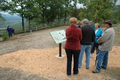
7. Thacher Park Centennial
Guests of the Centennial Celebration view the recently installed Thacher Point marker prior to the ceremony.
Photographed by Howard C. Ohlhous, September 14, 2014
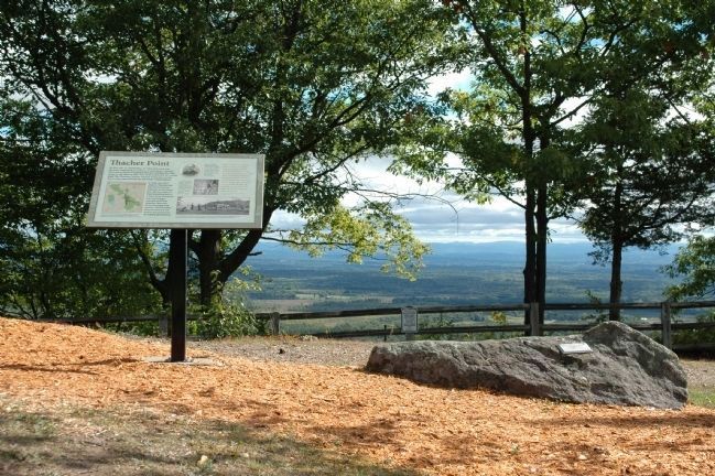
8. Thacher Point Marker(s)
Photographed by Howard C. Ohlhous, September 14, 2014
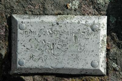
9. Another Thacher Point Marker
Only three steps away is a small metal marker attached to the exposed rock. Though a bit damaged, and barely legible, it is still possible to make out the words, "JOHN BOYD THACHER PARK...U S Geological Survey...1914"
Photographed by Howard C. Ohlhous, September 14, 2014
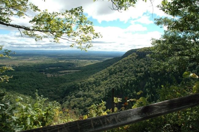
10. View From Thacher Point
One of the stunning views from Thacher Point.
Credits. This page was last revised on June 16, 2016. It was originally submitted on September 18, 2014, by Howard C. Ohlhous of Duanesburg, New York. This page has been viewed 792 times since then and 32 times this year. Photos: 1, 2, 3, 4. submitted on September 18, 2014, by Howard C. Ohlhous of Duanesburg, New York. 5, 6, 7, 8, 9, 10. submitted on September 19, 2014, by Howard C. Ohlhous of Duanesburg, New York. • Bill Pfingsten was the editor who published this page.
