
Weston in Platte County, Missouri — The American Midwest (Upper Plains)
Laurel Hill Cemetery
Photographed by William Fischer, Jr., August 1, 2014
1. Laurel Hill Cemetery Marker
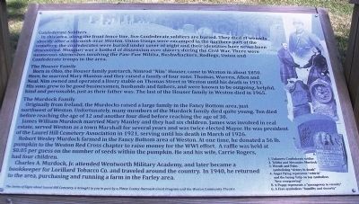
Confederate Soldiers
In this area, along the front fence line, five Confederates are buried. They died of wounds shortly after a skirmish near Weston. Union troops were encamped in the northern part of the cemetery, the confederates were buried under cover of night and their identities have never been discovered. Missouri was a hotbed of dissension over slavery during the Civil War. There were numerous skirmishes involving the Paw-Paw Militia, Bushwhackers, Redlegs, Union and Confederate troops in the area.
The Houser Family
Born in Ohio, the Houser family patriarch, Nimrod “Nim” Houser, came to Weston in about 1850. Here, he married Mary Blanton and they raised a family of four sons: Thomas, Warren, Allen and Neal. Nim owned and operated a livery stable on Thomas Street in Weston until his death in 1913. His sons grew to be good businessmen, husbands and fathers, and were known to be outgoing, helpful, kind and personable, just as their father was. The last of the Houser family died in Weston in 1965.
The Murdock Family
Originally from Ireland, the Murdocks raised a large family in the Fancy Bottom area,
this page online
James William Murdock married Mary Manley and they had six children. James was involved in real estate, served Weston as a town Marshall [sic] for several years and was twice elected Mayor. He was president of the Laurel Hill Cemetery Association in 1921, serving until his death in March of 1926.
Robert Wesley Murdock farmed in the Fancy Bottom area of Weston. At one time, he donated a 56 lb. pumpkin to the Weston Red Cross chapter to raise money for the WWI effort. A raffle was held at $0.05 per guess on the number of seeds within the pumpkin. He and his wife, Carrie Rogers, had four children.
Charles A. Murdock, Jr. attended Wentworth Military Academy, and later became a bookkeeper for Lorillard Tobacco Co. and traveled around the country. In 1940, he returned to the area, purchasing and running a farm in the Farley area.
[Inset photo captions, from top right to bottom right, read]
1. Unknown Confederate soldier
2. Telitha and Alexander Murdock
3.
Photographed by William Fischer, Jr., August 1, 2014
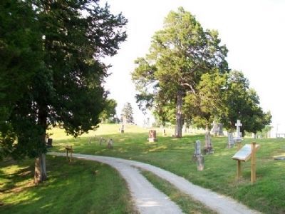
2. Laurel Hill Cemetery Marker
4. Angel Flying represents “rebirth” and the laying Tulip on top symbolizes “love evergrowing”
5. A Poppy represents a “passageway to eternity”
6. A Fern symbolizes “humility and sincerity”
Erected 2014 by Platte County Outreach Grant Program and the Weston Community Theatre.
Topics. This historical marker is listed in these topic lists: Cemeteries & Burial Sites • Patriots & Patriotism • Settlements & Settlers • War, US Civil. A significant historical month for this entry is March 1926.
Location. 39° 24.885′ N, 94° 53.852′ W. Marker is in Weston, Missouri, in Platte County. It can be reached from Welt Street. Marker is along the road through the cemetery, off Welt Street. Touch for map. Marker is in this post office area: Weston MO 64098, United States of America. Touch for directions.

Regionally, this marker is in Greater Kansas City. It is also in the American Midwest, in the Lewis & Clark Corridor, and in the Corn Belt. Globally, it is in North America, the Western Hemisphere, the Western World, and
Photographed by William Fischer, Jr.
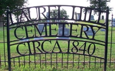
3. Laurel Hill Cemetery Sign
Other nearby markers. At least 8 other markers are within walking distance of this marker: A different marker also named Laurel Hill Cemetery (a few steps from this marker); a different marker also named Laurel Hill Cemetery (within shouting distance of this marker); a different marker also named Laurel Hill Cemetery (within shouting distance of this marker); a different marker also named Laurel Hill Cemetery (within shouting distance of this marker); Benjamin Wood House (approx. ¼ mile away); United Methodist Church (approx. ¼ mile away); Cody House (approx. ¼ mile away); Timeline of Weston History (approx. 0.3 miles away). Touch for a list and map of all markers in Weston.
Also see . . . Laurel Hill Cemetery, Weston MO. (Submitted on September 19, 2014, by William Fischer, Jr. of Reynoldsburg, Ohio.)
Credits. This page was last revised on June 16, 2016. It was originally submitted on September 19, 2014, by William Fischer, Jr. of Reynoldsburg, Ohio. This page has been viewed 602 times since then and 40 times this year. Photos: 1, 2, 3. submitted on September 19, 2014, by William Fischer, Jr. of Reynoldsburg, Ohio.
