Near Algoma in Kewaunee County, Wisconsin — The American Midwest (Great Lakes)
Bruemmerville
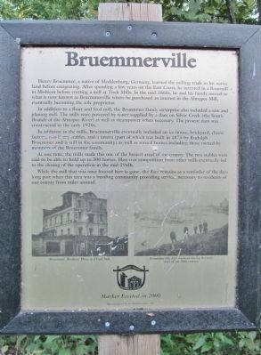
Henry Bruemmer, a native of Mecklenburg, Germany, learned the milling trade in his native land before emigrating. After spending a few years on the East Coast, he invested in a flourmill in Mishicot before operating a mill at Tisch Mills. In the mid-1860s, he and his family moved to what is now known as Bruemmerville where he purchased an interest in the Ahnapee Mill, eventually becoming the sole proprietor.
In addition to a flour and feed mill, the Bruemmer family enterprise also included a saw and planning mill. The mills were powered by water supplied by a dam on Silver Creek (the South Branch of the Ahnapee River) as well as steampower when necessary. The present dam was constructed in the early 1920s.
In addition to the mills, Bruemmerville eventually included an ice house, brickyard, cheese factory, two livery stables, and a tavern (part of which was built in 1875 by Randolph Bruemmer and is still in the community) as well as several homes including those owned by members of the Bruemmer family.
At one time, the mills made this one of the busiest areas of the county. The two stables were said to be able to hold up to 300 horses. However competition from other mills eventually led to the closing of the operation in the mid-1940s.
While the mill that was once located here is gone, the dam remains as a reminder of the days long past when this area was a bustling community providing services necessary to residents of our county from miles around.
Erected 2000 by the Kewaunee County Historical Society.
Topics. This historical marker is listed in these topic lists: Industry & Commerce • Man-Made Features • Settlements & Settlers • Waterways & Vessels. A significant historical year for this entry is 1875.
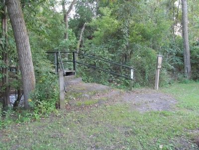
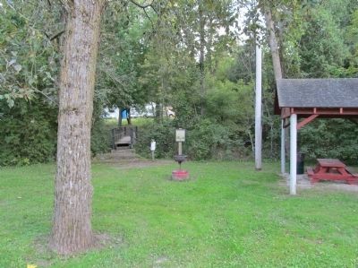
Location. 44° 36.476′ N, 87° 28.246′ W. Marker is near Algoma, Wisconsin, in Kewaunee County. Marker is on Willow Drive, 0.1 miles north of Fremont Road, on the left when traveling west. Marker is along Silver Creek in Bruemmerville County Park. Touch for map. Marker is in this post office area: Algoma WI 54201, United States of America. Touch for directions.
Other nearby markers. At least 8 other markers are within 2 miles of this marker, measured as the crow flies. The Lumber Industry in Algoma (approx. 1.3 miles away); Door-Kewaunee County College / Henry Diefenbach Sculptures (approx. 1.6 miles away); Brickyards (approx. 1.6 miles away); The Church of St. Agnes-by-the-Lake (approx. 1.6 miles away); American Legion Park (approx. 1.7 miles away); Officer Ronald L. Leist (approx. 1.8 miles away); Christmas Tree Ship Point
(approx. 1.9 miles away); Schooner Daniel Lyons (approx. 1.9 miles away). Touch for a list and map of all markers in Algoma.
More about this marker. photo captions:
• Bruemmer Brothers' Flour and Feed Mill.
• Brummerville dam washout during the early years of the 20th century.
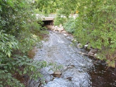
Regarding Bruemmerville. The Bruemmerville Dam, mentioned in the text of the marker, was removed in early 2013.
Also see . . .
1. Kewaunee County Historical Society Newsletter. History of Bruemmerville (Page 2). (Submitted on September 26, 2014.)
2. Bruemmerville Dam, Dam Removal and Stream Restoration. Robert E. Lee Associates website entry (Submitted on December 22, 2023, by Larry Gertner of New York, New York.)
Credits. This page was last revised on December 22, 2023. It was originally submitted on September 26, 2014, by Keith L of Wisconsin Rapids, Wisconsin. This page has been viewed 632 times since then and 25 times this year. Photos: 1, 2, 3, 4. submitted on September 26, 2014, by Keith L of Wisconsin Rapids, Wisconsin.


