Near Millboro Springs in Bath County, Virginia — The American South (Mid-Atlantic)
Fort Dickinson
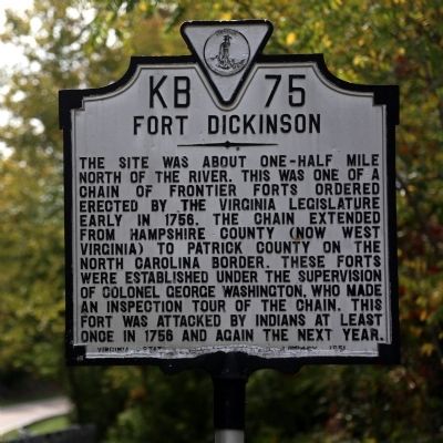
The site was about one-half mile north of the river. This was one of a chain of frontier forts ordered erected by the Virginia legislature early in 1756. The chain extended from Hampshire County (now West Virginia) to Patrick County on the North Carolina Border. These forts were established under the supervision of Colonel George Washington, who made an inspection tour of the chain. This fort was attacked by Indians at least once in 1756 and again the next year.
Erected 1951 by Virginia State Library. (Marker Number KB-75.)
Topics and series. This historical marker is listed in these topic lists: Colonial Era • Forts and Castles • War, French and Indian. In addition, it is included in the Former U.S. Presidents: #01 George Washington, and the Virginia Department of Historic Resources (DHR) series lists. A significant historical year for this entry is 1756.
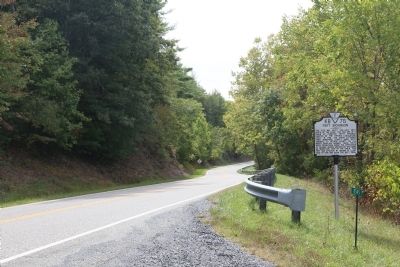
Location. 37° 58.342′ N, 79° 39.695′ W. Marker is near Millboro Springs, Virginia, in Bath County. Marker is on Cowpasture River Highway (Virginia Route 42) south of Mountain Valley Road (Virginia Route 39), on the right when traveling south. Touch for map. Marker is in this post office area: Millboro VA 24460, United States of America. Touch for directions.
Other nearby markers. At least 8 other markers are within 8 miles of this marker, measured as the crow flies. Camp Mont Shenandoah (approx. 1˝ miles away); Windy Cove Presbyterian Church (approx. 2.6 miles away); Millboro (approx. 3.2 miles away); T. C. Walker School (approx. 4.1 miles away); Bath County / Rockbridge County (approx. 7.2 miles away); Alleghany County / Rockbridge County (approx. 7.4 miles away); Alleghany County / Bath County (approx. 7.8 miles away); Settlement on Warm Springs Mountain (approx. 7.9 miles away). Touch for a list and map of all markers in Millboro Springs.
Regarding Fort Dickinson. The river mentioned on the marker is the Cowpasture River.
Also see . . . Fort Dickenson. Fortwiki website entry (Submitted on March 16, 2022, by Larry Gertner of New York, New York.)
Credits. This page was last revised on March 16, 2022. It was originally submitted on September 27, 2014, by J. J. Prats of Powell, Ohio. This page has been viewed 768 times since then and 73 times this year. Photos: 1, 2. submitted on September 27, 2014, by J. J. Prats of Powell, Ohio.

