Rothenburg ob der Tauber in Ansbach, Bavaria, Germany — Central Europe
Granary
Schrannenplatz
⎯⎯⎯
Jewish Cemetery
Judenkirchhof
| — | (ca 1339 - 1520) | — |
Photographed by William Fischer, Jr., September 28, 2013
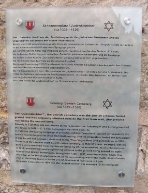
1. Granary/Jewish Cemetery Marker

Der „Judenkirchhof” war der Bestattungsplatz der jüdischen Einwohner und lag ursprünglich außerhalb der ersten Stadtmauer.
Bereits seit 1339 bezeichnete man den Platz als „coemeterium Judaeorum” (Begräbnisplatz der Juden).
In der Nähe wurde 1406/07 eine neue Synagoge gebaut.
Die judenfeindliche Hetze des Predigers Johann Teuschlein brachte den Stadtrat 1519 dazu, die Juden aus Rothenburg zu vertreiben. Daraufhin plünderte die Bevölkerung die Synagoge.
Sie wurde in eine Kapelle „Zur reinen Maria” umgewandelt und 1561 abgebrochen.
Ab 1520 nutzte man den Platz als christlichen Friedhof.
Bei seiner Erweiterung 1532/33 entfernten christliche Arbeiter die Gebeine aus den jüdischen Gräbern und brachten sie an einen heute unbekannten Ort.
Bei Tiefbauarbeiten im Jahr 1914 fand man am „Judenkirchhof” 33 mittelalterliche Grabsteine (1266-1395). Sie befinden sich heute im Reichstadtmuseum, im „Rabbi-Meir-Gärtchen” am Weißen Turm und im judischen Museum Franken in Fürth.
Erst 1958 wurde der „Judenkirchhof” in „Schrannenplatz” umbenannt.
Already
this page online
In 1519 the Jew-baiting campaign of preacher Johann Teuschlein caused consequently the town's council to evict its Jews from Rothenburg and the population looted the synagogue. It was turned into a chapel, dedicated to the 'Pure Virgin Mary' and pulled down in 1561.
From 1520 the site was used as a Christian cemetery. In 1532/33 it was enlarged, with the bones being removed from the Jewish tombs by Christian workers to an unknown site.
In 1914, when underground engineering work led to the grounds being opened up again, 33 medieval Jewish tombstones, dating from 1266-1395, were discovered. Today they are either at the Reichsstadtmuseum, in the surrounding wall of the Rabbi-Meir-Garden next to the White Tower, or in the Jewish Museum of Franconia in Fürth.
However, it was only in 1958 that the 'Judenkirchhof' was renamed 'Schrannenplatz'.
Erected by City of Rothenburg ob der Tauber.
Topics. This historical marker is listed in these topic lists: Agriculture • Cemeteries & Burial Sites
Photographed by William Fischer, Jr., September 28, 2013
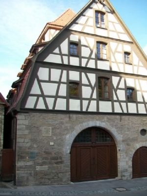
2. Granary and Jewish Cemetery Marker
Location. 49° 22.752′ N, 10° 10.733′ E. Marker is in Rothenburg ob der Tauber, Bayern (Bavaria), in Ansbach. It is on Schrannenplatz just south of Fuchsengäßchen, on the right when traveling south. Touch for map. Marker is in this post office area: Rothenburg ob der Tauber BY 91541, Germany. Touch for directions.

Regionally, this marker is in German Franconia and on the Romantic Road. Globally, it is in Europe, the European Union, Atlantic Europe, Central Europe, the Schengen Area, Western Europe, and the Western World. Historically, it finds itself in what was once the Holy Roman Empire and also the former West Germany.
Other nearby markers. At least 8 other markers are within walking distance of this marker: Schrannenscheune / Grain Storage Barn (a few steps from this marker); Jews's Alley and Jewish Quarter (within shouting distance of this marker); Pulverturm / Powder Tower (about 90 meters away, measured in a direct line); Türme der Nordflanke / Towers of the north flank (about 90 meters away); St.-Michaels-Kapelle Rothenburg ob der Tauber / St Michaels Chapel
Photographed by William Fischer, Jr., September 28, 2013
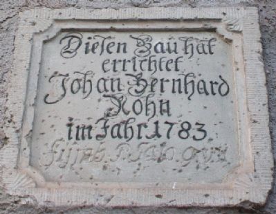
3. Engraved Stone Marker on Granary Wall
Also see . . .
1. History of Rothenburg ob der Tauber. City website entry (Submitted on October 4, 2014, by William Fischer, Jr. of Reynoldsburg, Ohio.)
2. Rabbi Meir of Rothenburg. Geni website entry (Submitted on October 4, 2014, by William Fischer, Jr. of Reynoldsburg, Ohio.)
3. Reichstadtmuseum, Rothenburg o.d. Tauber. Rothenberg Museum website homepage (Submitted on October 4, 2014, by William Fischer, Jr. of Reynoldsburg, Ohio.)
Photographed by William Fischer, Jr., September 28, 2013
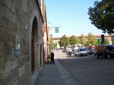
4. Looking North from Granary/Jewish Cemetery Marker
Credits. This page was last revised on June 28, 2023. It was originally submitted on October 4, 2014, by William Fischer, Jr. of Reynoldsburg, Ohio. This page has been viewed 670 times since then and 23 times this year. Photos: 1, 2, 3, 4. submitted on October 4, 2014, by William Fischer, Jr. of Reynoldsburg, Ohio.
