Near Merkel in Taylor County, Texas — The American South (West South Central)
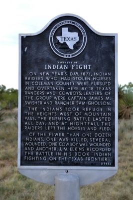
Vicinity of Indian Fight
The Indians took refuge in the heights west of Mountain Pass. The ensuing battle lasted all day, and at nightfall the raiders left the horses and fled.
Of the fewer than one dozen Indians, one was killed, several wounded. One cowboy was wounded and another, J.M. Elkins, recorded the battle in his book “Indian Fighting on the Texas Frontier”.
Erected 1968 by Texas Historical Commission. (Marker Number 5646.)
Topics. This historical marker is listed in these topic lists: Native Americans • Wars, US Indian. A significant historical year for this entry is 1871.
Location. 32° 23.838′ N, 99° 58.296′ W. Marker is near Merkel, Texas, in Taylor County. Marker is on Farm to Market Road 1235 south of County Road 302, on the right when traveling south. Touch for map. Marker is in this post office area: Merkel TX 79536, United States of America. Touch for directions.
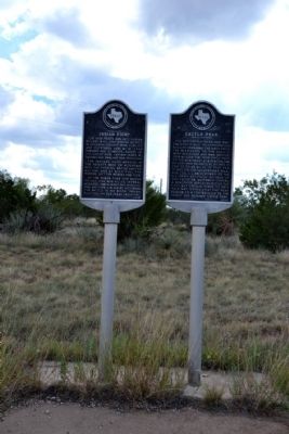
Other nearby markers. At least 8 other markers are within 8 miles of this marker, measured as the crow flies. Castle Peak (here, next to this marker); Mulberry Canyon (approx. 5.7 miles away); Cornelia Clark Fort (approx. 5.7 miles away); Drummond Cemetery (approx. 6 miles away); Camp Barkeley (approx. 6.7 miles away); Butterfield Trail (approx. 6.8 miles away); Butterfield Mail and Stage Line (approx. 6.8 miles away); Mountain Pass Station (approx. 7.1 miles away). Touch for a list and map of all markers in Merkel.
Credits. This page was last revised on June 16, 2016. It was originally submitted on October 6, 2014, by Duane Hall of Abilene, Texas. This page has been viewed 588 times since then and 29 times this year. Photos: 1, 2, 3, 4. submitted on October 6, 2014, by Duane Hall of Abilene, Texas.


