North Haverhill in Grafton County, New Hampshire — The American Northeast (New England)
Rogers Rangers
Photographed by Don Morfe, May 24, 2013
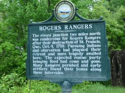
1. Rogers Rangers Marker
The rivers’ junction two miles north was rendezvous for Rogers Rangers after their destruction of St. Francis, Que., Oct. 4, 1759. Pursuing Indians and starvation had plagued their retreat and more tragedy awaited here. The expected rescue party bringing food had come and gone. Many Rangers perished and early settlers found their bones along these intervales.
Erected by New Hampshire Division of Historical Resources. (Marker Number 056.)
Topics and series. This memorial is listed in this topic list: War, French and Indian. In addition, it is included in the New Hampshire Historical Highway Markers series list. A significant historical year for this entry is 1759.
Location. 44° 7.667′ N, 72° 1.983′ W. Memorial is in Haverhill, New Hampshire, in Grafton County. It is in North Haverhill. It is on Dartmouth College Highway 0.2 miles south of S. Court Street. Touch for map. Memorial is in this post office area: North Haverhill NH 03774, United States of America. Touch for directions.

Regionally, this memorial is in the White Mountains. It is also in the American Northeast and in New England. Globally, it is in North
this page online
Other nearby markers. At least 8 other markers are within 2 miles of this marker, measured as the crow flies: Ebenezer MacKintosh (approx. 1½ miles away); Veterans Memorial (approx. 1.7 miles away); Haverhill World War II Honor Roll (approx. 1.7 miles away); Town Clock (approx. 1.7 miles away); Haverhill-Bath Bridge (approx. 1.8 miles away); Bayley-Hazen Military Road (approx. 1.8 miles away in Vermont); World War II Memorial (approx. 1.8 miles away in Vermont); Wells River School Alumni (approx. 1.8 miles away in Vermont). Touch for a list and map of all markers in Haverhill.
Photographed by Don Morfe, May 24, 2013
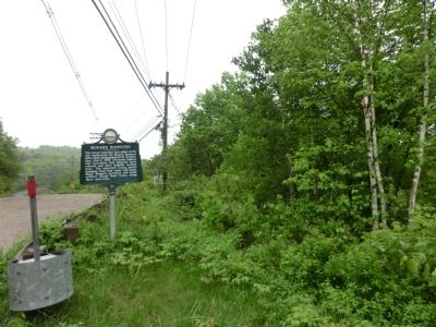
2. Rogers Rangers Marker

Photographed by Jimmy Emerson, October 2, 2026
3. Rogers Rangers Marker
Credits. This page was last revised on October 15, 2026. It was originally submitted on June 10, 2013, by Don Morfe of Baltimore, Maryland. This page has been viewed 2,091 times since then and 162 times this year. Last updated on October 8, 2014, by Kevin Craft of Bedford, Quebec. Photos: 1, 2. submitted on June 10, 2013, by Don Morfe of Baltimore, Maryland. 3. submitted on October 6, 2026, by Jimmy Emerson of Dalton, Georgia. • Bill Pfingsten was the editor who published this page.
