Northwood in Rockingham County, New Hampshire — The American Northeast (New England)
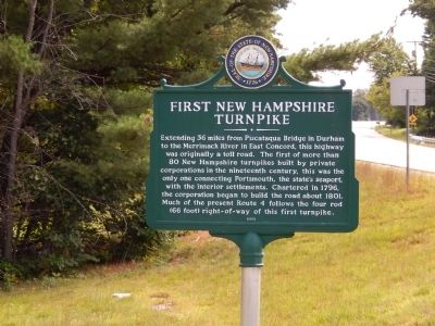
First New Hampshire Turnpike
Extending 36 miles from Piscataqua Bridge in Durham to the Merrimack River in East Concord, this highway was originally a toll road. The first of more than 80 New Hampshire turnpikes built by private corporations in the nineteenth century, this was the only one connecting Portsmouth, the state's seaport, with the interior settlements. Chartered in 1796, the corporation began to build the road about 1801. Much of the present Route 4 follows the four rod (66 foot) right-of-way of this first turnpike.
Erected 2002 by New Hampshire Division of Historical Resources. (Marker Number 181.)
Topics and series. This historical marker is listed in this topic list: Roads & Vehicles. In addition, it is included in the New Hampshire Historical Highway Markers series list. A significant historical year for this entry is 1796.
Location. 43° 13.399′ N, 71° 15.246′ W. Marker is in Northwood, New Hampshire, in Rockingham County. Marker is on U.S. 4 just south of Old Turnpike Road. Touch for map. Marker is in this post office area: Northwood NH 03261, United States of America. Touch for directions.
Other nearby markers. At least 8 other markers are within 6 miles of this marker, measured as the crow flies. Northwood Parade 1775 (approx. 2.6 miles away); Northwood NH WWI Honor Roll (approx. 2.6 miles away); Northwood NH War Memorial (approx. 2.6 miles away); Northwood NH WWII Honor Roll (approx. 2.6 miles away); LaFayette's Tour (approx. 2.6 miles away); Major Andrew McClary (approx. 4 miles away); Site of the First Congregational Church (approx. 5.4 miles away); Major John Simpson (approx. 5.6 miles away). Touch for a list and map of all markers in Northwood.
Credits. This page was last revised on June 16, 2016. It was originally submitted on August 22, 2014, by Bill Pfingsten of Bel Air, Maryland. This page has been viewed 508 times since then and 34 times this year. Last updated on October 9, 2014, by Kevin Craft of Bedford, Quebec. Photos: 1, 2. submitted on August 22, 2014, by Bill Pfingsten of Bel Air, Maryland.

