Taylor in Loup County, Nebraska — The American Midwest (Upper Plains)
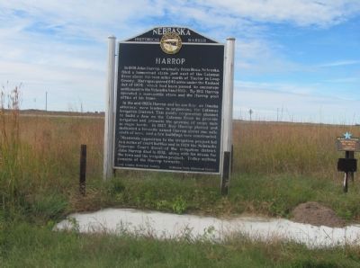
Harrop
In the mid-1920s Harrop and his son Roy, an Omaha attorney, were leaders in organizing the Calamus Irrigation District. This public operation planned to build a dam on the Calamus River to provide irrigation and promote the growing of crops such as sugar beets. In 1927 Roy Harrop platted and dedicated a townsite named Harrop about one mile south of here, and a few buildings were constructed.
Meanwhile opposition to the irrigation project led to a series of court battles and in 1929 the Nebraska Supreme Court dissolved the irrigation district. John Harrop died in 1932, along with his dream for the town and the irrigation project. Today nothing remains of the remains of the Harrop townsite
Erected by Loup County Historical Society; Nebraska State Historical Society. (Marker Number 375.)
Topics and series. This historical marker is listed in these topic lists: Agriculture • Settlements & Settlers. In addition, it is included in the Nebraska State Historical Society series list. A significant historical year for this entry is 1908.
Location. 42° 0.816′ N, 99° 27.31′ W. Marker is in Taylor, Nebraska, in Loup County. Marker is on U.S. 183, on the right when traveling north. This marker is located just north of the junction with State Highway 96 north of the Calamus Reservoir. Touch for map. Marker is in this post office area: Taylor NE 68879, United States of America. Touch for directions.
Other nearby markers. At least 1 other marker is within 11 miles of this marker, measured as the crow flies. Valleyview (approx. 10.9 miles away).
More about this marker. There is a small picnic area in conjunction with the historical marker.
Credits. This page was last revised on June 16, 2016. It was originally submitted on October 12, 2014, by Joan Shurtliff of Seward, Nebraska. This page has been viewed 749 times since then and 8 times this year. Photos: 1, 2. submitted on October 12, 2014, by Joan Shurtliff of Seward, Nebraska. • Andrew Ruppenstein was the editor who published this page.

