Blair in Washington County, Nebraska — The American Midwest (Upper Plains)
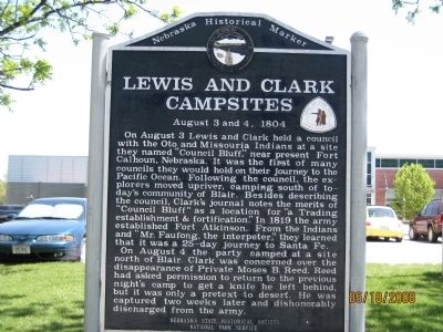
Lewis and Clark Campsites
August 3 and 4, 1804
Inscription.
On August 3 Lewis and Clark held a council with the Oto and Missouria Indians at a site they named "Council Bluff," near present Fort Calhoun, Nebraska. It was the first of many councils they would hold on their journey to the Pacific Ocean. Following the council, the explorers moved upriver, camping south of today's community of Blair. Besides describing the council, Clark's journal notes the merits of "Council Bluff" as a location for "a Trading establishment & fortification." In 1819 the army established Fort Atkinson. From the Indians and "Mr. Faufong, the interpeter," they learned that it was a 25-day journey to Santa Fe.
On August 4 the party camped at a site north of Blair. Clark was concerned over the disappearance of Private Moses B. Reed. Reed had asked permission to return to the previous night's camp to get a knife he left behind, but it was only a pretext to desert. He was captured two weeks later and dishonorably discharged from the army.
Erected by Nebraska State Historical Society, National Park Service. (Marker Number 342.)
Topics and series. This historical marker is listed in these topic lists: Exploration • Industry & Commerce • Native Americans • Settlements & Settlers. In addition, it is included in the Lewis & Clark Expedition, and the Nebraska State Historical Society series lists. A significant historical year for this entry is 1819.
Location. 41° 32.093′ N, 96° 7.863′ W. Marker is in Blair, Nebraska, in Washington County. Marker is located in front of the Blair YMCA. Touch for map. Marker is at or near this postal address: 1278 Wilbur St, Blair, NE 68008, Blair NE 68008, United States of America. Touch for directions.
Other nearby markers. At least 8 other markers are within 7 miles of this marker, measured as the crow flies. Congregational Church of Blair (approx. half a mile away); DeSoto Townsite (approx. 3.1 miles away); Brewster Cemetery (approx. 4.2 miles away); Cuming City Cemetery and Nature Preserve (approx. 4.3 miles away); Up the Missouri (approx. 5.1 miles away); The Lewis and Clark Expedition (approx. 5.1 miles away); Steamboat Bertrand (approx. 5.3 miles away); Lewis and Clark Campsite Area (approx. 6.7 miles away). Touch for a list and map of all markers in Blair.
Credits. This page was last revised on October 28, 2019. It was originally submitted on May 19, 2008, by Michael James of Fort Calhoun, Nebraska. This page has been viewed 1,747 times since then and 21 times this year. Photo 1. submitted on May 19, 2008, by Michael James of Fort Calhoun, Nebraska. • Kevin W. was the editor who published this page.
