Port Wallace in Dartmouth in Halifax Region, Nova Scotia — The Atlantic Provinces (North America)
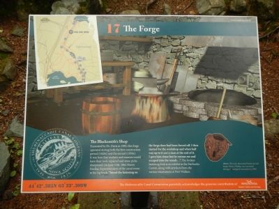
The Forge
Photographed by Barry Swackhamer, June 15, 2014
1. The Forge Marker
Excavated by Dr. Davis in 1985, this forge operated during both the first construction period (1820s) and the second (1850s). It was here that workers and masons would have their tools repaired and stone picks sharpened. On June 10th, 1862 Henry Findlay, Superintendent of the canal wrote in his log book: “found the fastening on the forge door had been forced off. I then started for the workshop and when half way up to it saw a man at the end of it. I gave him chase but he outran me and escaped into the woods…”. The broken fastening lock is on exhibit in the Fairbanks Centre, along with artefacts from the various excavations at Port Wallace.
Erected by Shubenacadie Canal Commission. (Marker Number 17.)
Topics. This historical marker is listed in this topic list: Waterways & Vessels. A significant historical month for this entry is June 1849.
Location. 44° 42.385′ N, 63° 33.309′ W. Marker is in Dartmouth, Nova Scotia, in Halifax Region. It is in Port Wallace. It can be reached from Locks Road, on the left when traveling north. Touch for map. Marker is at or near this postal address: 54
this page online

Regionally, this marker is in the Halifax Area. It is also in the Maritimes and in Atlantic Canada. Globally, it is in the North Atlantic Region, North America, the Western Hemisphere, the Western World, and the Anglosphere. Historically, it finds itself in what was once a British colony, the Viceroyalty of New France, and Acadia.
Other nearby markers. At least 8 other markers are within walking distance of this marker: One of the mysteries yet to be solved… (about 180 meters away, measured in a direct line); Shubenacadie Canal, Port Wallace (about 210 meters away); Benching - An early construction technique (about 210 meters away); Summit of the Canal (about 210 meters away); Deep Cut (approx. 0.4 kilometers away); Navvies Dwelling (approx. 0.4 kilometers away); Canal Shubenacadie Canal (approx. 0.4 kilometers away); Waste Weir and Holding Pond (approx. 0.4 kilometers away). Touch for a list and map of all markers in Dartmouth.
More about this marker. This marker is inside Shubie Park beside the canal.
Photographed by Barry Swackhamer, June 15, 2014
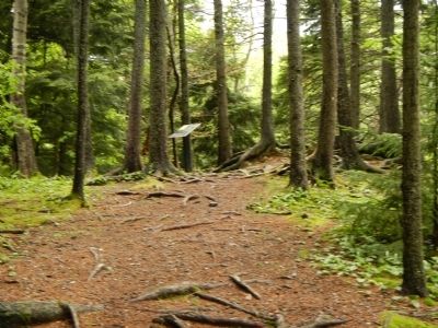
2. The Forge Marker
Photographed by Barry Swackhamer, June 15, 2014
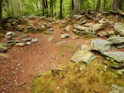
3. Ruins of the Blacksmith's shop
Credits. This page was last revised on June 16, 2016. It was originally submitted on October 14, 2014, by Barry Swackhamer of Brentwood, California. This page has been viewed 501 times since then and 17 times this year. Photos: 1, 2, 3. submitted on October 14, 2014, by Barry Swackhamer of Brentwood, California. • Andrew Ruppenstein was the editor who published this page.
