Port Wallace in Dartmouth in Halifax Region, Nova Scotia — The Atlantic Provinces (North America)
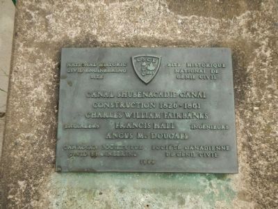
Canal Shubenacadie Canal
National Historic Civil Engineering Site
⎯⎯⎯
Site Historique National de Génie Civil
Photographed by Barry Swackhamer, June 15, 2014
1. Canal Shubenacadie Canal Marker
Charles William Fairbanks
Francis Hall
Angus McDougall
Engineers / Ingénieurs
Erected 1984 by Canadian Society for Civil Engineering / Société Canadienne de Génie Civil.
Topics. This historical marker is listed in this topic list: Waterways & Vessels.
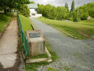
Location. 44° 42.159′ N, 63° 33.275′ W. Marker is in Dartmouth, Nova Scotia, in Halifax Region. It is in Port Wallace. It can be reached from Locks Road, on the left when traveling north. This marker is in Shubie Park near the parking lot. Touch for map. Marker is at or near this postal address: 54 Locks Rd, Dartmouth NS B2X 2M1, Canada. Touch for directions.

Regionally, this marker is in the Halifax Area. It is also in the Maritimes and in Atlantic Canada. Globally, it is in the North Atlantic Region, North America, the Western Hemisphere, the Western World, and the Anglosphere. Historically, it finds itself in what was once a British colony, the Viceroyalty of New France, and Acadia.
Other nearby markers. At least 8 other markers are within walking distance of this marker:
this page online
Photographed by Barry Swackhamer, June 15, 2014
2. Canal Shubenacadie Canal Marker
Credits. This page was last revised on June 16, 2016. It was originally submitted on October 14, 2014, by Barry Swackhamer of Brentwood, California. This page has been viewed 483 times since then and 21 times this year. Photos: 1, 2. submitted on October 14, 2014, by Barry Swackhamer of Brentwood, California. • Andrew Ruppenstein was the editor who published this page.
