Port Wallace in Dartmouth in Halifax Region, Nova Scotia — The Atlantic Provinces (North America)
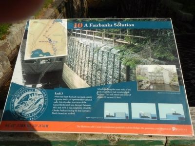
The Fairbanks Solution
Photographed by Barry Swackhamer, June 15, 2014
1. The Fairbanks Solution Marker
Caption: Right: Diagram of Lock 3
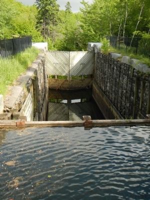
When first built this lock was made entirely of granite blocks, as represented by the end walls. Like the other structures of the Canal, this lock fell into disrepair between 1831 and 1854. It was completely rebuilt by Charles Fairbanks using the less expensive North American method.
When operating the inner walls of the Lock would have had wooden plank surfaces. The lock raised and lowered vessels 3.7 meters (12 feet).
Erected by Shubenacadie Canal Commission. (Marker Number 10.)
Topics. This historical marker is listed in this topic list: Waterways & Vessels. A significant historical year for this entry is 1831.
Location. 44° 42.118′ N, 63° 33.276′ W. Marker is in Dartmouth, Nova Scotia, in Halifax Region. It is in Port Wallace. It can be reached from Locks Road. Touch for map. Marker is at or near this postal address: 54 Locks Road, Dartmouth NS B2X 2M1, Canada. Touch for directions.

Regionally, this marker is in the Halifax Area. It is also in the Maritimes and in Atlantic Canada. Globally, it is in the North Atlantic Region, North America, the Western Hemisphere, the Western World, and the
this page online
Other nearby markers. At least 8 other markers are within walking distance of this marker: Historic Shubenacadie Canal System (a few steps from this marker); Official Groundbreaking 1829 (within shouting distance of this marker); Before the Canal (within shouting distance of this marker); Waste Weir and Holding Pond (within shouting distance of this marker); Canal Shubenacadie Canal (within shouting distance of this marker); Of Bough and Bark (about 120 meters away, measured in a direct line); A Village of the Most Primitive Description (about 180 meters away); Navvies Dwelling (about 180 meters away). Touch for a list and map of all markers in Dartmouth.
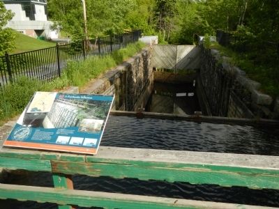
More about this marker. This marker is in Shubie Park on the bridge over Lock 3.
Photographed by Barry Swackhamer, June 15, 2014
2. The Fairbanks Solution Marker
Photographed by Barry Swackhamer, June 15, 2014
3. Lock 3
Photographed by Barry Swackhamer, June 15, 2014
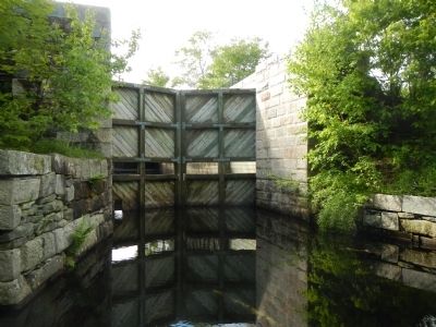
4. The gates of Lock 3
Credits. This page was last revised on June 16, 2016. It was originally submitted on October 14, 2014, by Barry Swackhamer of Brentwood, California. This page has been viewed 463 times since then and 19 times this year. Photos: 1, 2, 3, 4. submitted on October 14, 2014, by Barry Swackhamer of Brentwood, California. • Andrew Ruppenstein was the editor who published this page.
