Port Wallace in Dartmouth in Halifax Region, Nova Scotia — The Atlantic Provinces (North America)
Lightning Strikes at Canal Camp
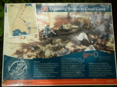
Photographed by Barry Swackhamer, June 15, 2014
1. Lightning Strikes at Canal Camp Marker
The most concentrated number of features belonging to the Canal Camp are located in this area beneath the trees and along the roadway. You can still make out the remains of several stone foundations. A plan of this area prepared in 1826 shows a line of small cottages or huts. Approximately three hundred navvies (from the word “navigator” or canal labourer) worked and lived here with their families from 1826 to 1831. A newspaper article of the time reports that on one Sunday morning in September, 1827 a bolt of lightning ”ripped through the roof of the most northerly shed, which housed twenty people. Three were asleep in an upper bunk, in such close condition that Timothy Kannady, squeezed into the middle of the trio, reportedly had his head resting on his neighbour’s arm. The bolt killed him instantly much to the incredulity of his housemates, who were certain that he must have just slept through the calamity. Two other men, a woman and a child were all severely burned in the incident, while one man, who was enjoying a cup of tea, had the bowl blown apart in his hands.”
Erected by Shubenacadie
this page online
Topics. This historical marker is listed in this topic list: Waterways & Vessels. A significant historical month for this entry is September 1827.
Location. 44° 41.98′ N, 63° 33.141′ W. Marker is in Dartmouth, Nova Scotia, in Halifax Region. It is in Port Wallace. It can be reached from Locks Road, on the left when traveling north. Touch for map. Marker is at or near this postal address: 54 Locks Rd, Dartmouth NS B2X 2J5, Canada. Touch for directions.

Regionally, this marker is in the Halifax Area. It is also in the Maritimes and in Atlantic Canada. Globally, it is in the North Atlantic Region, North America, the Western Hemisphere, the Western World, and the Anglosphere. Historically, it finds itself in what was once a British colony, the Viceroyalty of New France, and Acadia.
Other nearby markers. At least 8 other markers are within walking distance of this marker: Historic Shubenacadie Canal System (within shouting distance of this marker); Barges, Steamboats and Scows (within shouting distance of this marker); Unique Construction (within shouting distance of this marker); A Testament to Hard Work (within shouting distance of this marker); A Village of the Most Primitive Description (about 120 meters away, measured in a direct line); Of Bough and Bark (about 210 meters away); A Changing Lake-scape (about 210 meters away); Before the Canal (approx. 0.3 kilometers away). Touch for a list and map of all markers in Dartmouth.
More about this marker. This marker is located in Shubie Park
Credits. This page was last revised on June 16, 2016. It was originally submitted on October 14, 2014, by Barry Swackhamer of Brentwood, California. This page has been viewed 508 times since then and 16 times this year. Photo 1. submitted on October 14, 2014, by Barry Swackhamer of Brentwood, California. • Andrew Ruppenstein was the editor who published this page.
