Near Dardanelle in Tuolumne County, California — The American West (Pacific Coastal)
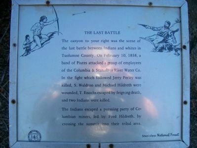
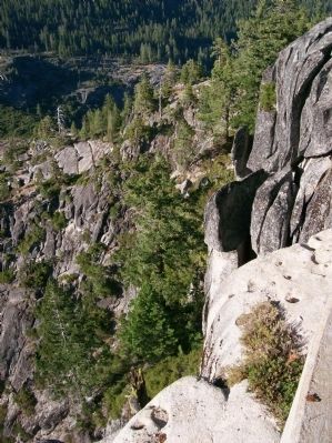
The Last Battle
The Indians escaped a pursuing party of Columbian miners, led by Fred Hildreth, by crossing the summit into their tribal area.
Erected by USFS, Stanislaus National Forest.
Topics. This historical marker is listed in this topic list: Wars, US Indian. A significant historical month for this entry is February 1961.
Location. 38° 20.516′ N, 119° 55.482′ W. Marker is near Dardanelle, California, in Tuolumne County. Marker can be reached from Mono Way (California Route 108) 15.2 miles east of Herring Creek Lane. Heading east on Hwy 108 toward Sonora Pass, from Herring Creek Road in Strawberry (this is the street the Post Office is on), go 15.2 miles to Donnell's Vista (sometimes called Donnell's Overlook). Turn into the parking area on the left and park. Touch for map. Marker is in this post office area: Tuolumne CA 95379, United States of America. Touch for directions.
Other nearby markers. At least 8 other markers are within 11 miles of this marker, measured as the crow flies. Route of the Bartleson-Bidwell Party - 1841 (a few steps from this marker); Hayes Station (approx. 7.7 miles away); Jewels of the High Country (approx. 9.9 miles away); The Emigrants of 1852-1853 (approx. 9.9 miles away); Reynold’s House (approx. 10.3 miles away); Bedrock Mortars (approx. 10.4 miles away); Following in their Footsteps - East Flange Rock (approx. 10˝ miles away); Old Emigrant Road (approx. 10˝ miles away).
More about this marker. There is a paved footpath that leads from the southeast corner of the parking area down to the overlook. The sign is along this path.
Credits. This page was last revised on June 16, 2016. It was originally submitted on October 18, 2014, by James King of San Miguel, California. This page has been viewed 813 times since then and 40 times this year. Photos: 1, 2. submitted on October 18, 2014, by James King of San Miguel, California. • Syd Whittle was the editor who published this page.
Editor’s want-list for this marker. Wide area view of the marker and its surroundings. • Can you help?

