Near Pleasanton in Linn County, Kansas — The American Midwest (Upper Plains)
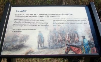
Cavalry
The battle at Mine Creek was one of the largest cavalry battles of the Civil War. Thousands of men and horses took part in the engagement.
Cavalry regiments played an important role. In the beginning they supported the infantry and artillery and screened their movements from the enemy. They also gathered information as to the whereabouts and strength of enemy troops. After victorious battles they pursued and harassed the retreating troops; in a defeat they covered the rear of their own army and executed defensive actions to delay the advance of the enemy. Toward the end of the war the cavalry took on a more offensive role such as it did at Mine Creek.
Erected 2012 by Kansas State Historical Society.
Topics. This historical marker is listed in these topic lists: Animals • War, US Civil.
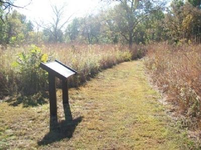
Location. 38° 8.382′ N, 94° 43.52′ W. Marker is near Pleasanton, Kansas, in Linn County. Marker is along the mowed trail, about one-half mile SSW of the Mine Creek Civil War Battlefield State Historic Site Visitor Center. Touch for map. Marker is at or near this postal address: 20485 Kansas Highway 52, Pleasanton KS 66075, United States of America. Touch for directions.
Other nearby markers. At least 8 other markers are within walking distance of this marker. Battle of Mine Creek (about 700 feet away, measured in a direct line); Cavalry Horses (about 700 feet away); Nursing the Wounded (approx. 0.2 miles away); Lieutenant Colonel Frederick W. Benteen Memorial Bridge (approx. 0.2 miles away); Conclusion of Price Campaign (approx. 0.2 miles away); "Hurra for Kansas!" (approx. ¼ mile away); Chaos at the Crossing (approx. ¼ mile away); Union Charge (approx. 0.3 miles away). Touch for a list and map of all markers in Pleasanton.
Also see . . .
1. Mine Creek Battle. Kansapedia website entry (Submitted on October 21, 2014, by William Fischer, Jr. of Scranton, Pennsylvania.)
2. Mine Creek Civil War Battlefield. Kansas Historical Society website entry (Submitted on January 16, 2022, by Larry Gertner of New York, New York.)
Credits. This page was last revised on January 16, 2022. It was originally submitted on October 21, 2014, by William Fischer, Jr. of Scranton, Pennsylvania. This page has been viewed 483 times since then and 9 times this year. Photos: 1, 2, 3. submitted on October 21, 2014, by William Fischer, Jr. of Scranton, Pennsylvania.


