
Yorktown in York County, Virginia — The American South (Mid-Atlantic)
Cornwallis Headquarters
1781 Siege of Yorktown
Photographed by Evan Dwyer, April 11, 2026
1. Cornwallis Headquarters Marker
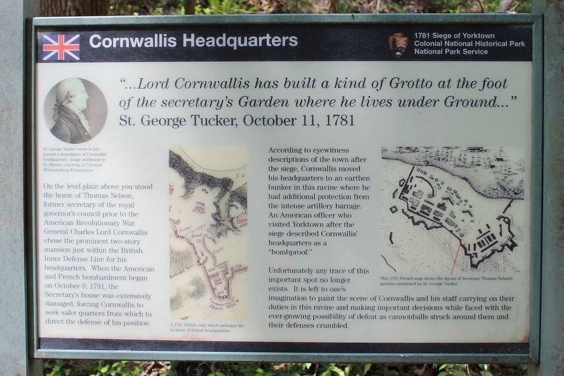
"…Lord Cornwallis has built a kind of Grotto at the foot of the secretary's Garden where he lives under Ground…" – St. George Tucker, October 11, 1781
On the level plain above you stood the home of Thomas Nelson, former secretary of the royal governor's council prior to the American Revolutionary War. General Charles Lord Cornwallis chose the prominent two story mansion just within the British Inner Defense Line for his headquarters. When the American and French bombardment began on October 9, 1781, the secretary's house was extensively damaged, forcing Cornwallis to seek safer quarters from which to direct the defense of his position.
According to eyewitness descriptions of the town after the siege, Cornwallis moved his headquarters to an earthen bunker in this ravine where he had additional protection from the intense artillery barrage. An American officer who visited Yorktown after the siege described Cornwallis' headquarters as a "bombproof."
Unfortunately any trace of this important spot no longer exists. It is left to one's imagination to paint the scene of Cornwallis and his staff carrying on their
this page online
Erected by Colonial National Historical Park, National Park Service.
Topics. This historical marker is listed in this topic list: War, US Revolutionary. A significant historical date for this entry is October 11, 1856.
Location. 37° 13.853′ N, 76° 30.297′ W. Marker is in Yorktown, Virginia, in York County. It can be reached from Water Street 0.1 miles east of Compte de Grasse Street, on the right when traveling east. The marker is along the Tobacco Road Trail which connects the east section of Water Street with the NPS Visitor Center. Touch for map. Marker is at or near this postal address: 1000 Colonial Parkway, Yorktown VA 23690, United States of America. Touch for directions.

Regionally, this marker is on Virginia’s Peninsula, in Coastal Virginia, and in the Hampton Roads Metropolitan Area. It is also in the American South, specifically in the Upper South, in the Tidewater, and on the Eastern Seaboard. Globally, it is in the North Atlantic Region, North America,
Photographed by David Graff, September 20, 2014
2. Cornwallis Headquarters Marker
Other nearby markers. At least 8 other markers are within walking distance of this marker: Tobacco Road (about 300 feet away, measured in a direct line); British Inner Defense Line (about 400 feet away); Yorktown (about 400 feet away); The Hornwork (about 400 feet away); Secretary Nelson’s House (about 400 feet away); Home of Thomas Nelson (about 400 feet away); Don't Tread on Me! (about 400 feet away); a different marker also named Yorktown (about 600 feet away). Touch for a list and map of all markers in Yorktown.
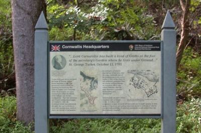
Regarding Cornwallis Headquarters. The marker contains two Revolutionary War era maps of this location and Yorktown. There is also a portrait of St. George Tucker, an American Continental soldier who kept a journal of the siege.
Photographed by David Graff, September 20, 2014
3. Cornwallis Headquarters Marker
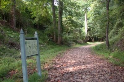
Looking north along the Tobacco Road Trail in the ravine.

Photographed by David Graff, September 20, 2014
4. Tobacco Road Trail
Looking south from the marker en route to the NPS Visitor Center.
Credits. This page was last revised on April 22, 2026. It was originally submitted on October 22, 2014, by David Graff of Halifax, Nova Scotia. This page has been viewed 2,346 times since then and 172 times this year. Photos: 1. submitted on April 18, 2026, by Evan Dwyer of Richmond, Virginia. 2, 3, 4. submitted on October 22, 2014, by David Graff of Halifax, Nova Scotia. • Bernard Fisher was the editor who published this page.
