Marker Logo HMdb.org THE HISTORICAL
MARKER DATABASE
“Bite-Size Bits of Local, National, and Global History”
Tonawanda in Erie County, New York — The American Northeast (Mid-Atlantic)
 

Erie Canal Site


Erie Canal Site Marker image. Click for full size.
Photographed By Anton Schwarzmueller, September 13, 2014
1. Erie Canal Site Marker
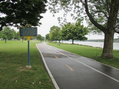
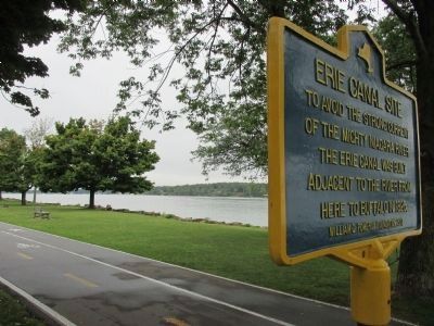
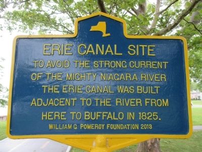
Inscription. To avoid the strong current of the mighty Niagara River, the Erie Canal was built adjacent to the river from here to Buffalo in 1825.
 
Erected 2013 by William G. Pomeroy Foundation.
 
Topics and series. This historical marker is listed in this topic list: Waterways & Vessels. In addition, it is included in the Erie Canal, and the William G. Pomeroy Foundation series lists. A significant historical year for this entry is 1825.
 
Location. 43° 0.969′ N, 78° 53.549′ W. Marker is in Tonawanda, New York, in Erie County. Marker is located in Nia-Wanda Park on Shoreline Trail, a walkway/bikeway along the Niagara River. Marker is between the Niagara River and the parallel Niagara Street (NY 266) opposite the Franklin Street intersection with Niagara Street. Touch for map. Marker is in this post office area: Tonawanda NY 14150, United States of America. Touch for directions.
 
Other nearby markers. At least 8 other markers are within walking distance of this marker. Great Ships of the Niagara (within shouting distance of this marker); Grand Island Ferry (approx. ¼ mile away); Engineering the Erie Canal (approx. ¼ mile away); Dedicated to the Memory (approx. 0.3 miles away); To The Glory of God and in Grateful Remembrance (approx. 0.3 miles away); The Brewery (approx. 0.4 miles away);
Paid Advertisement
Click on the ad for more information.
Please report objectionable advertising to the Editor.
Click or scan to see
this page online
Tonawanda All Heroes Memorial (approx. 0.4 miles away); Railroad Station (approx. 0.7 miles away). Touch for a list and map of all markers in Tonawanda.
 
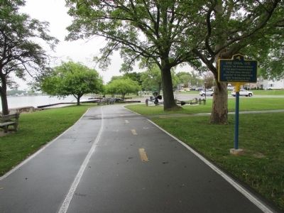
Erie Canal Site Marker image. Click for full size.
Photographed By Anton Schwarzmueller, September 13, 2014
2. Erie Canal Site Marker
southward
Erie Canal Site Marker image. Click for full size.
Photographed By Anton Schwarzmueller, September 13, 2014
3. Erie Canal Site Marker
northward
Erie Canal Site Marker image. Click for full size.
Photographed By Anton Schwarzmueller, 52
4. Erie Canal Site Marker
Southward. The east branch of the Niagara River is in the background. The Niagara River is split by Grand Island here; the other side of the east branch is Grand Island, NY (not Ontario, Canada).
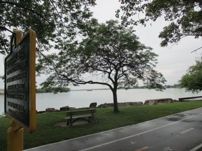
Erie Canal Site Marker image. Click for full size.
Photographed By Anton Schwarzmueller, September 13, 2014
5. Erie Canal Site Marker
Northward. In the background from left to right: Grand Island (NY), the east branch of the Niagara River, Tonawanda Island.
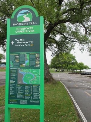
Shoreline Trail Sign image. Click for full size.
Photographed By Anton Schwarzmueller, September 13, 2014
6. Shoreline Trail Sign
Zoom in and the outline of the left side of the marker is seen behind the tree by the boat prop directly ahead on the trail (southward).
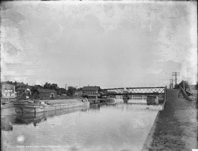
Erie Canal, Tonawanda, NY image. Click for full size.
Photographed By Detroit Publishing Company, circa 1905
7. Erie Canal, Tonawanda, NY
 
 
Credits. This page was last revised on June 16, 2016. It was originally submitted on September 23, 2014, by Anton Schwarzmueller of Wilson, New York. This page has been viewed 514 times since then and 8 times this year. Last updated on October 27, 2014, by Anton Schwarzmueller of Wilson, New York. Photos:   1, 2, 3, 4, 5, 6. submitted on September 23, 2014, by Anton Schwarzmueller of Wilson, New York.   7. submitted on September 27, 2014. • Bill Pfingsten was the editor who published this page.
Share this page.  
Share on Tumblr
m=78352

CeraNet Cloud Computing sponsors the Historical Marker Database.
This website earns income from purchases you make after using our links to Amazon.com. We appreciate your support.
Paid Advertisement
Apr. 25, 2024