Thamesville in Chatham-Kent, Ontario — Central Canada (North America)
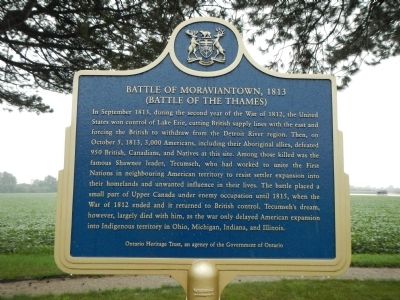
Battle of Moraviantown, 1813
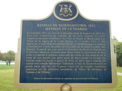
Bataille de Moraviantown, 1813
| — | (Battle of the Thames) / (Bataille de la Thames) | — |
Photographed by Barry Swackhamer, August 11, 2014
1. Battle of Moraviantown, 1813 Marker (English side)

French
this page online
Erected by Ontario Heritage Trust.
Topics and series. This historical marker is listed in these topic lists: Indigenous Peoples and Communities • War of 1812. In addition, it is included in the Canada, Ontario Heritage Trust series list. A significant historical date for this entry is October 5, 1813.
Location. 42° 33.931′ N, 81° 55.858′ W.
Photographed by Barry Swackhamer, August 11, 2014
2. Battle of Moraviantown, 1813 Marker (French side)

Regionally, this marker is in the Southwest Ontario Area and in Southwestern Ontario. It is also in Central Canada. Globally, it is in North America, on the Great Lakes, in the Western Hemisphere, in the Western World, and in the Anglosphere. Historically, it finds itself in what was once a British colony, the Viceroyalty of New France, the Haudenosaunee (Iroquois) Confederacy, and Rupert’s Land.
Other nearby markers. At least 8 other markers are within walking distance of this marker: Tecumseh (within shouting distance of this marker); Prelude to Battle (within shouting distance of this marker); Why Choose This Site? (within shouting distance of this marker); Participants in the Battle of the Thames (about 90 meters away, measured in a direct line); a different marker also named Participants in the Battle of the Thames (about 90 meters away); a different
Photographed by Barry Swackhamer, August 11, 2014
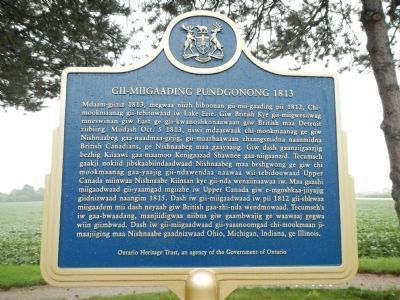
3. Gii-Miigaading Pundgonong, 1813 Marker
This marker, next to the marker above, is in an unidentified First Nations language (possibly Ojibwe?). Click on this image to enlarge it.
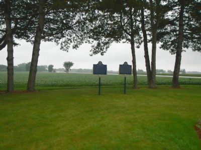
More about this marker. These markers are located on unnamed side road leading south along with other markers relating to the Battle of the Thames.
Regarding Battle of Moraviantown, 1813. The Battle of the Thames (sometimes called the Battle of Moraviantown) occurred 5 October 1813, during the War of 1812. Following the American naval victory under Captain Oliver H. Perry in the Battle of Lake Erie at Put-in-Bay on 10 September 1813, the entire western peninsula of Upper Canada was in danger of falling into enemy hands. Major General Henry Procter, who commanded all British and Canadian forces west of Burlington, was short of supplies and decided to retreat up the River Thames. (Submitted on October 29, 2014, by Barry Swackhamer of Brentwood, California.)
Related markers. Click here for a list
Photographed by Barry Swackhamer, August 11, 2014
4. Battle of Moraviantown, 1813 Marker
Also see . . . Battle of the Thames (Moraviantown). "The Canadian Encyclopedia" entry (Submitted on July 27, 2020, by Larry Gertner of New York, New York.)
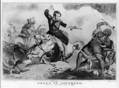
Photographed by Currier and Ives, 1846
5. The Death of Tecumseh
Print shows Col. R.M. Johnson using a pistol to kill Tecumseh during the War of 1812, at the battle of the Thames in Ontario, Canada.
When Johnson later ran for political office, his campaign slogan ran:
"Rumsey-dumsey,
Rumsey-dumsey,
Colonel Johnson
Killed Tecumseh."
When Johnson later ran for political office, his campaign slogan ran:
"Rumsey-dumsey,
Rumsey-dumsey,
Colonel Johnson
Killed Tecumseh."
Credits. This page was last revised on May 27, 2026. It was originally submitted on October 29, 2014, by Barry Swackhamer of Brentwood, California. This page has been viewed 1,615 times since then and 88 times this year. Photos: 1, 2, 3, 4, 5. submitted on October 29, 2014, by Barry Swackhamer of Brentwood, California. • Andrew Ruppenstein was the editor who published this page.
