Chuckwalla in Riverside County, California — The American West (Pacific Coastal)
36th Evacuation Hospital (SM)
Photographed by Michael Kindig, January 13, 2011
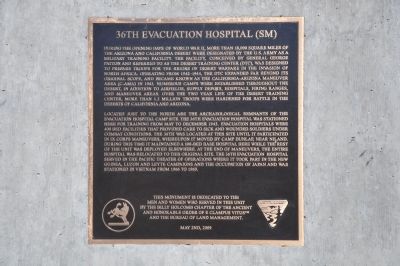
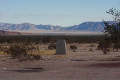
1. 36th Evacuation Hospital (SM) Marker
Located just to the north are the archaeological remnants of the evacuation hospital camp site. The 36th Evacuation Hospital was stationed here for training from May to December 1943. Evacuation hospitals were 400 bed facilities that provided care to sick and wounded soldiers under combat conditions. The 36th was located
this page online
This monument is dedicated to the men and women who served in this unit by the Billy Holcomb Chapter of the Ancient and Honorable Order of E Clampus Vitus and the Bureau of Land Management.
Re-Erected April 19th 2014/6019
Erected 2014 by Billy Holcomb Chapter No. 1069 of the Ancient and Honorable Order of E Clampus Vitus and the Bureau of Land Management. (Marker Number 149.)
Topics and series. This historical marker is listed in these topic lists: Notable Places • Science & Medicine • War, World II. In addition, it is included in the Desert Training Center, and the E Clampus Vitus series lists. A significant historical date for this entry is April 19, 1910.
Location. 33° 42.248′ N,
Photographed by Michael Kindig, January 13, 2011
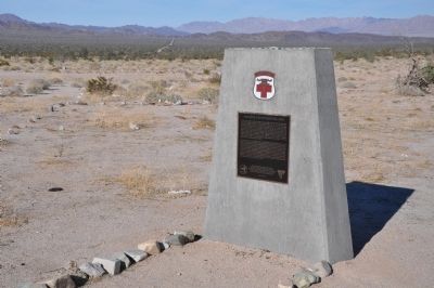
2. 36th Evacuation Hospital (SM) Marker

Regionally, this marker was in Greater Los Angeles, in the Coachella Valley, and in the Peninsular Ranges. It was also in the American Southwest. Globally, it was in North America, on the Ring of Fire, on the Pacific Rim, in the Western Hemisphere, in the Western World, and in the Anglosphere. Historically, it found itself in what was once New Spain and also Mexico’s Alta California.
Other nearby markers. At least 3 other markers are within 19 miles of this marker, measured as the crow flies: Corn Springs (approx. 9.1 miles away); Gus Lederer 1868-1932 (approx. 9.2 miles away); Palen Pass (approx. 18.3 miles away).
Other markers no longer nearby. Eagle Mountain Iron (was approx. 2.9 miles away but has been confirmed missing); Coxcomb Divisional Camp (was approx. 18.3 miles away).
More about this marker. Here
Photographed by "Turbo" Dave Hicks, April 18, 2014
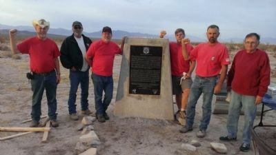
3. 36th Evacuation Hospital (SM) Marker with Re-Erection Crew
Eric Nielsen, Neal Samson, Rick Gavigan, Tim Nunn, Dennis Parker, Bill Pearson, and Dave Hicks (not shown) were responsible for restoring this monument.
Also see . . .
1. Desert Training Center. Wikipedia entry (Submitted on January 18, 2024, by Larry Gertner of New York, New York.)
2. Desert Training Center. Dedicated website homepage (Submitted on January 18, 2024, by Larry Gertner of New York, New York.)
Photographed by "Turbo" Dave Hicks, April 18, 2014
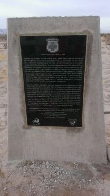
4. 36th Evacuation Hospital (SM) Marker
Photographed by Chris English, December 5, 2013
5. 36th Evacuation Hospital (SM) Missing Marker Base
Credits. This page was last revised on January 18, 2024. It was originally submitted on January 9, 2012, by Michael Kindig of Elk Grove, California. This page has been viewed 3,580 times since then and 145 times this year. Last updated on November 3, 2014, by Michael Kindig of Elk Grove, California. Photos: 1, 2. submitted on January 9, 2012, by Michael Kindig of Elk Grove, California. 3, 4. submitted on April 20, 2014, by Michael Kindig of Elk Grove, California. 5. submitted on December 25, 2013, by Chris English of Phoenix, Arizona. • Bill Pfingsten was the editor who published this page.
