Near Lucerne Valley in San Bernardino County, California — The American West (Pacific Coastal)
Old Woman Springs Ranch
Photographed by Michael Kindig, January 16, 2011
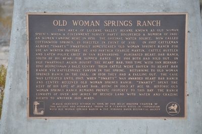
1. Old Woman Springs Ranch Marker
this page online
Erected 2004 by Billy Holcomb Chapter No. 1069 of the Ancient and Honorable Order of E Clampus Vitus in cooperation with Old Woman Springs Ranch & the Morongo Basin Historical Society. (Marker Number 118.)
Topics and series. This historical marker is listed in these topic lists: Indigenous Peoples and Communities • Industry & Commerce • Notable Places • Settlements & Settlers. In addition, it is included in the E Clampus Vitus series list. A significant historical year for this entry is 1856.
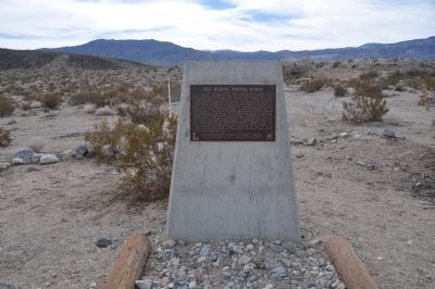
Location. 34° 24.423′ N, 116° 43.194′ W. Marker is near Lucerne Valley, California, in San Bernardino County. It is on Old Woman Springs Road (California Route 247) west of Stoney Ridge Road, on the right when traveling east. Touch for map. Marker is in this post office area: Lucerne Valley CA 92356, United States of America. Touch for directions.

Regionally, this marker is in Greater Los Angeles, in the Peninsular Ranges, and specifically in the Transverse Ranges. It is also in the American Southwest. Globally, it is in North America, on the Ring of Fire, on the Pacific Rim, in the Western Hemisphere,
Photographed by Michael Kindig, January 16, 2011
2. Old Woman Springs Ranch Marker
Other nearby markers. At least 8 other markers are within 14 miles of this marker, measured as the crow flies: The Pigmy Cabin (approx. 11.6 miles away); Bellevill Holcomb Valley (approx. 12 miles away); People Came and Left This Meadow (approx. 12 miles away); Main Museum Building (approx. 12.1 miles away); a different marker also named Holcomb Valley (approx. 12.1 miles away); 5 Stamp Mill (approx. 12.1 miles away); Woodland Club Caddy Shack (approx. 12.2 miles away); Willie Boy (approx. 13.1 miles away).
Another marker is no longer nearby. Holcomb Valley (was approx. 12 miles away but has been confirmed missing).
Also see . . . Quick History of Lucerne Valley. It is said the Indians used to leave their elders camped there while the young ones went into the mountains after pinion nuts. (Submitted on January 19, 2012.)
Credits. This page was last revised on November 17, 2020. It was originally submitted on January 9, 2012, by Michael Kindig of Elk Grove, California. This page has been viewed 4,571 times since then and 242 times this year. Last updated on November 3, 2014, by Michael Kindig of Elk Grove, California. Photos: 1, 2. submitted on January 9, 2012, by Michael Kindig of Elk Grove, California. • Bill Pfingsten was the editor who published this page.
