Athens in Menard County, Illinois — The American Midwest (Great Lakes)
Abraham Lincoln, Deputy Surveyor, Sangamon County, Illinois
1833 – 1837

Photographed by Jason Voigt, February 22, 2025
1. Abraham Lincoln, Deputy Surveyor, Sangamon County, Illinois Marker
Beginning January 1, 1834, New Salem was to receive mail on a new schedule. The Stage was to leave Springfield each Saturday at 4:00 am for the Warren Court House in Mommouth, Illinois, by the way of Sangamo Town, Athens, New Salem, Havana, Lewistown, Canton, and Knox Court House (Knoxville), a distance of 115 miles.
Return mail was to leave Warren Court House each Tuesday at 6:00 am, arriving in Springfield at 10:00 pm Thursday.
On June 3, 1854, Abraham Lincoln as the Deputy County Surveyor of Sangamon County, Illinois was appointed by the County Commissioners Court to survey the relocation of the road from Sangamo Town to Athens. The survey was completed on November 4, 1834 and the road became known as “The Post Road”.
Lincoln started his survey at Sangamo Town and ended by setting a stone at the intersection of what is now known as Main Street and Jefferson Street in Athens.
Erected 2005 by Illinois Professional Land Surveyors Association.
Topics and series. This historical marker is listed in this topic list: Roads & Vehicles.
this page online
Location. 39° 57.606′ N, 89° 43.429′ W. Marker is in Athens, Illinois, in Menard County. It is at the intersection of South Main Street and Jefferson Street, on the left when traveling south on South Main Street. Touch for map. Marker is at or near this postal address: 200 S Main St, Athens IL 62613, United States of America. Touch for directions.

Regionally, this marker is in Central Illinois, specifically in the Illinois River Valley, and in Greater Springfield. It is also in the American Midwest and in the Corn Belt. Globally, it is in North America, the Western Hemisphere, the Western World, and the Anglosphere. Historically, it finds itself in what was once the territory of the Mississippian Culture and also the Northwest Territory.
Other nearby markers. At least 8 other markers are within 3 miles of this marker, measured as the crow flies: Long Nine Banquet Site (here, next to this marker); Lincoln and the City of Athens (within shouting distance of this marker); Mott & Henning Funeral Home
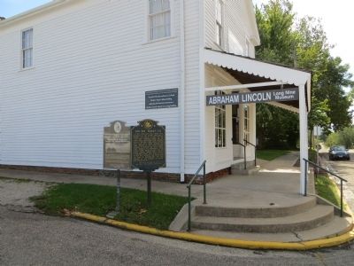
Photographed by Bill Kirchner, October 3, 2014
2. Abraham Lincoln, Deputy Surveyor, Sangamon County, Illinois Marker on the left
Long Nine Banquet Site Marker is on the right.
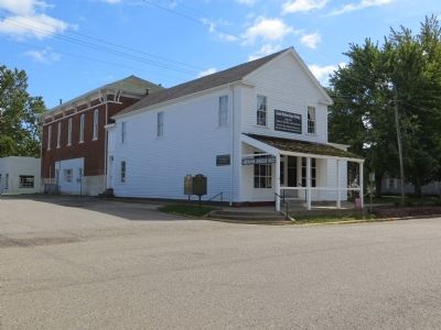
Photographed by Bill Kirchner, October 3, 2014
3. Main Street and Jefferson Street in Athens
Credits. This page was last revised on February 25, 2025. It was originally submitted on November 3, 2014, by Bill Kirchner of Tucson, Arizona. This page has been viewed 1,536 times since then and 60 times this year. Photos: 1. submitted on February 25, 2025, by Jason Voigt of Glen Carbon, Illinois. 2, 3. submitted on November 3, 2014, by Bill Kirchner of Tucson, Arizona. • Al Wolf was the editor who published this page.
