Near Petersburg in Dinwiddie County, Virginia — The American South (Mid-Atlantic)
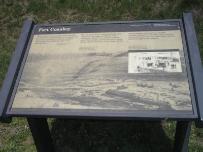
Fort Conahey
Photographed by Bill Coughlin, April 24, 2007
1. Fort Conahey Marker
“This fort has cost more labour than any other, has afforded an admirable lesson in engineering, and is one of the sights to show to strangers. Further than this I doubt the value of its elaborateness.”
- Col. Charles Wainwright, USA November 20, 1864
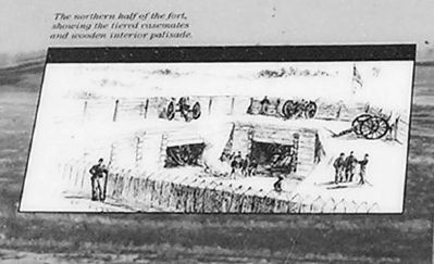
Here, unmolested by Confederate bullets and cannons, Union engineering built the most technically elaborate fort on the Petersburg front. Fort Conahey included two tiers of guns, sturdy wooded casemates, and a unique wooden interior palisade that acted as a traverse. Located a mile from Confederate lines, Conahey rarely came under fire from Confederate cannons and never suffered direct attack.
Erected by Petersburg National Battlefield - National Park Service - Department of the Interior.
Topics. This historical marker is listed in these topic lists: Forts and Castles • War, US Civil. A significant historical month for this entry is November 1885.
Location. 37° 10.314′ N, 77° 26.757′ W. Marker is near Petersburg, Virginia, in Dinwiddie County. It is on Flank Road, on the right when traveling west. Marker is in Petersburg National Battlefield along the Siege Line
this page online

Regionally, this marker is in the Piedmont, in Southside Virginia, and specifically in Central Virginia. It is also in the American South and specifically in the Upper South. Globally, it is in North America, the Western Hemisphere, the Western World, and the Anglosphere. Historically, it finds itself in what was once the territory of the Mississippian Culture, one of the original Thirteen Colonies, one of the Confederate States of America, and the Antebellum South.
Other nearby markers. At least 8 other markers are within walking distance of this marker: Siege of Petersburg—Grant's Fifth Offensive (approx. 0.4 miles away); The Largest Fort (approx. half a mile away); Petersburg Battlefields (approx. half a mile away); a different marker also named Petersburg Battlefields (approx. 0.7 miles away); Life Between the Picket Lines (approx. ¾ mile away); Contested Ground (approx. 0.8 miles away); a different marker also named Petersburg Battlefields (approx. 0.8 miles away); a different marker also
Photographed by Bill Coughlin, April 24, 2007
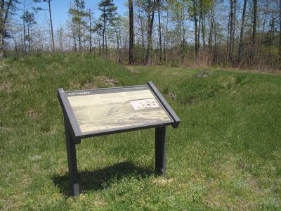
2. Marker in Petersburg National Battlefield
This fort was constructed in October 1864 on ground captured by the Union during the Battle of Peebles Farm.
More about this marker. The marker is dominated by a war-time photograph with the caption “This photo was taken from the Peebles Farm signal tower, a quarter mile south of here. Fort Conahey is in the center.”
The right side of the marker also contains a picture of “The northern half of the fort, showing the tiered casemates and wooden interior palisade.”
Also see . . .
1. Heritage Documentation Programs. Fort Conahey: Assessment of the Principal Earthworks: The Federal "Fish Hook" Line, Petersburg, VA. (Submitted on May 22, 2008, by Bill Coughlin of Woodland Park, New Jersey.)
2. Petersburg National Battlefield. National Park Service. (Submitted on May 22, 2008, by Bill Coughlin of Woodland Park, New Jersey.)
Photographed by Linda Walcroft
3. Illustration on right-hand side of the marker
Credits. This page was last revised on February 2, 2023. It was originally submitted on May 22, 2008, by Bill Coughlin of Woodland Park, New Jersey. This page has been viewed 2,508 times since then and 69 times this year. Photos: 1, 2. submitted on May 22, 2008, by Bill Coughlin of Woodland Park, New Jersey. 3. submitted on May 28, 2009, by Linda Walcroft of Woodstock, Virginia. • Craig Swain was the editor who published this page.
