Near North Bend in Hamilton County, Ohio — The American Midwest (Great Lakes)
Fort Finney
Southwest Corner of Ohio
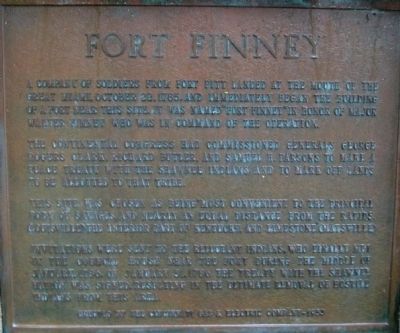
The Continental Congress had commissioned Generals George Rogers Clark, Richard Butler and Samuel Parsons to make a peace treaty with the Shawnee Indians and to mark off lands to be allotted to that tribe.
This site was chosen as being most convenient to the principal body of savages and nearly an equal distance from the rapids, (Louisville) the interior of Kentucky, and Limestone (Maysville)
Invitations were sent to the reluctant Indians, who finally met in the Council House near the fort during the middle of January, 1786. On January 31, 1786 the treaty with the Shawnee Nation was signed, resulting in the ultimate removal of hostile Indians from this area. erected by the Cincinnati Gas & Electric Company- 1953
Erected 1953 by Cincinnati Gas & Electric Company.
Topics. This historical marker is listed in these topic lists: Settlements & Settlers • Wars, US Indian. A significant historical date for this entry is January 13, 1786.
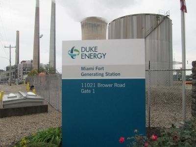
Location. 39° 7.113′ N, 84° 48.262′ W. Marker is near North Bend, Ohio, in Hamilton County. Marker is on Brower Road, on the right when traveling east. marker is at Gate #1 of the Miami Fort Generating Station, left side of driveway. Touch for map. Marker is at or near this postal address: 11021 Brower Rd, North Bend OH 45052, United States of America. Touch for directions.
Other nearby markers. At least 8 other markers are within 3 miles of this marker, measured as the crow flies. Point Farm (here, next to this marker); Miami Fort / Fort Finney (a few steps from this marker); 1801 Miller Burying Ground (approx. 2 miles away in Indiana); Bullittsburg Baptist Church (approx. 2.2 miles away in Kentucky); Indiana - Ohio State Line Monument (approx. 2.3 miles away); Lawrenceburg's First Hospital (approx. 2.8 miles away in Indiana); Isaac Dunn House (approx. 2.8 miles away in Indiana); Whitewater Canal (approx. 2.8 miles away in Indiana). Touch for a list and map of all markers in North Bend.
Credits. This page was last revised on June 16, 2016. It was originally submitted on November 4, 2014, by Rev. Ronald Irick of West Liberty, Ohio. This page has been viewed 1,066 times since then and 72 times this year. Photos: 1, 2, 3, 4, 5. submitted on November 4, 2014, by Rev. Ronald Irick of West Liberty, Ohio. • Al Wolf was the editor who published this page.
