Near Grand Pré in Kings County, Nova Scotia — The Atlantic Provinces (North America)
Grand-Pré Rural Historic District
Arrondissement Historique Rurual de Grand-Pré
Inscription.
English
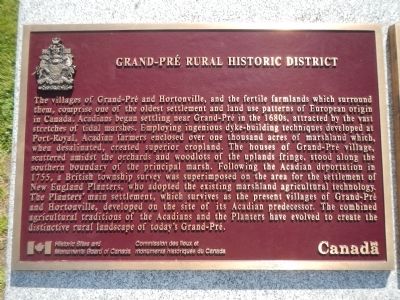
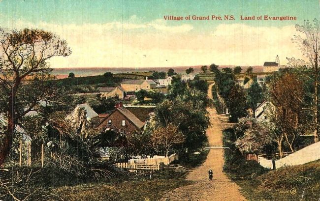
The villages of Grand-Pré and Hortonville, and the fertile farmlands which surround them, comprise one of the oldest settlement and land use patterns of European origin in Canada. Acadians began settling near Grand-Pré in the 1680s, attracted by the vast stretches of tidal marshes. Employing ingenious dyke-building techniques developed at Port-Royal, Acadian farmers enclosed over one thousand acres of marshlands which, when desalinated, created superior cropland. The houses of Grand-Pré village, scattered amidst the orchards and woodlots of the upper fringe, stood along the southern boundary of the principal marsh. Following the Acadian deportation in 1755, a British township survey was superimposed on the area for the settlement of New England Planters, who adopted the existing marshland agricultural technology. The Planters’ main settlement, which survives as the present villages of Grand-Pré and Hortonville, developed on the site of its Acadian predecessor. The combined agricultural traditions of the Acadians and the Planters have evolved to create a distinctive rural landscape of today’s Grand-Pré.
French
Les villages de Grand-Pré et de Hortonville, ainsi que les fertiles terres agricole qui les entourent, présentent un de modèles européens de colonisation et d’utilisation des terres parmi les plus anciens au Canada. Attirés par les vastes marais côtiers, les Acadiens s’établirent dans les envions de Grand-Pré à partier de années 1680. Les fermiers acadiens utilisèrent les techniques ingénieuses de construction de digues développées à Port-Royal pour encore plus de mille acres de marais qui, un fois dessalé, constituèrent des terres labourables de grande qualité. Les maisons du village de Grand-Pré, situées au milieu des vergers et des boisés des hauteurs périphériques, bordaient la limite sud de marais principal. Après la deportation des Acadiens en 1755, les terres furent redivisées en cantons à la manière britannique en vue de l’arrivée des Planters de la Nouvelle-Angleterre, qui adoptèrent la technologue agricole en place. Le principal établissement des Planters, aujourd’hui les villages de Grand-Pré et de Hortonville, se développa sur le site de l’établissement acadien précédent, Le paysage rural distinctif de l’actuel Grand-Pré est le produit de l’évolution des traditions agricoles des Acadiens et des Acadiens et des Planters.
Erected by Historic Sites and Monument Board of Canada/Commission de lieux et monuments historique du Canada.
Topics and series. This historical marker is listed in these topic lists: Agriculture • Settlements & Settlers
. In addition, it is included in the Acadian History, and the Canada, Historic Sites and Monuments Board series lists. A significant historical year for this entry is 1755.
Location. 45° 6.499′ N, 64° 18.59′ W. Marker is near Grand Pré, Nova Scotia, in Kings County. Marker can be reached from Grand-Pré Road close to Old Post Road, on the left when traveling north. Touch for map. Marker is at or near this postal address: 2205 Grand-Pré Road, Grand Pré NS B0P, Canada. Touch for directions.
Other nearby markers. At least 8 other markers are within 3 kilometers of this marker, measured as the crow flies. The Expulsion of the Acadians (within shouting distance of this marker); Statue of Evangeline (about 210 meters away, measured in a direct line); Memorial Church/L'église-souvenir (approx. 0.2 kilometers away); Grand Pre Marsh Body (approx. 0.3 kilometers away); The Attack at Grand Pré/La bataille Grand Pré (approx. half a kilometer away); The Landscape of Grand Pré/Le Paysage de Grand-Pré (approx. half a kilometer away); Landscape of Grand Pré/ le Payage de Grand Pré (approx. 2 kilometers away); Site de l'école Acacia Villa/Site of Acacia Villa School (approx. 2 kilometers away). Touch for a list and map of all markers in Grand Pré.
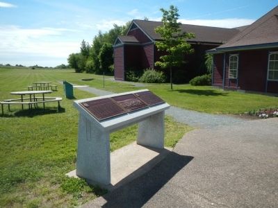
More about this marker. This marker is on the grounds of the Grand-Pré Rural Historic
Site,
Also see . . .
1. Grand-Pré, Nova Scotia - Wikipedia. Wikipedia entry:
Its French name translates to "Great Meadow" and the community lies at the eastern edge of the Annapolis Valley several kilometres east of the town of Wolfville on a peninsula jutting into the Minas Basin surrounded by extensive dyked farm fields, framed by the Gaspereau and Cornwallis Rivers. The community was made famous by Henry Wadsworth Longfellow's poem Evangeline and is today home to the Grand-Pré National Historic Site. On June 30, 2012, the Landscape of Grand-Pré was named a World Heritage Site by UNESCO. (Submitted on November 8, 2014, by Barry Swackhamer of Brentwood, California.)
2. Grand Pré National Historic Site of Canada. Parks Canada website entry:
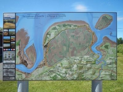
Today, the name Grand-Pré is applied to a loosely defined geographic area, which consists of several thousand acres of cultivated marshlands and gently rolling uplands containing farms, orchards and the continuous villages of Grand-Pré, North Grand-Pré and Hortonville. (Submitted on November 8, 2014, by Barry Swackhamer of Brentwood, California.)
Credits. This page was last revised on December 17, 2023. It was originally submitted on November 8, 2014, by Barry Swackhamer of Brentwood, California. This page has been viewed 489 times since then and 15 times this year. Photos: 1, 2, 3, 4, 5. submitted on November 8, 2014, by Barry Swackhamer of Brentwood, California. 6. submitted on November 8, 2014. • Andrew Ruppenstein was the editor who published this page.
