Denfeld in Duluth in Saint Louis County, Minnesota — The American Midwest (Upper Plains)
Oneota
Photographed by William Fischer, Jr., October 11, 2014
1. Oneota Marker
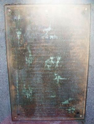
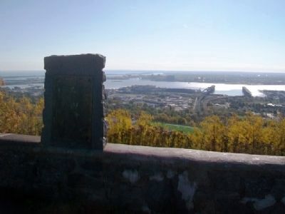
Originally the area below was called Oneota, one of several early towns which survived to form modern Duluth. Oneota was the site of the first sawmill in the region, built in 1855 at the present site of the iron ore docks. Among the early residents of Oneota were Lewis Merritt and his seven sons, known as the "seven iron men", who helped open the Mesabi Range and built one of the first railroads to transport iron ore to Lake Superior docks. At the far right is Morgan Park, former site of a large steel and cement making complex. Built in 1915, Morgan Park was one of the first planned communities in the nation. As one's eye moves eastward one sees Grassy Point; the Lake Superior Paper Company; Minnesota Power Co's Hibbard Power Plant; the Richard Bong Memorial Bridge, Wheeler Field; Wade Municipal Stadium; docks which load pellets and ore onto Lake vessels, a storage yard for taconite pellets; a panorama of St. Louis Bay (Duluth's inner harbor) to Rice's Point and the John A. Blatnik High Bridge; the Outer Harbor; Minnesota Point; and the Aerial Life Bridge; Lake Superior and the Enger Memorial Tower.
One of a series of
this page online
Erected 1972 by Duluth Lions Club and the Duluth Area Chamber of Commerce Convention & Visitors Bureau.
Topics. This historical marker is listed in these topic lists: Bridges & Viaducts • Industry & Commerce • Settlements & Settlers • Waterways & Vessels. A significant historical year for this entry is 1855.
Location. 46° 45.819′ N, 92° 9.189′ W. Marker is in Duluth, Minnesota, in Saint Louis County. It is in Denfeld. It is on Skyline Parkway, on the left when traveling west. Marker is at a roadside overlook, between North 27th Avenue and Haines Road (Minnesota 91). Touch for map. Marker is in this post office area: Duluth MN 55806, United States of America. Touch for directions.

Regionally, this marker is in the Arrowhead Region and in the Iron Range. It is also in the American Midwest and in the Corn Belt. Globally, it is in North America, in the Great North Woods, on the Great Lakes, in the Western Hemisphere, in the Western World, and in the
Photographed by William Fischer, Jr., October 11, 2014
2. Oneota Marker
Other nearby markers. At least 8 other markers are within 2 miles of this marker, measured as the crow flies: Rice's Point (approx. 1.6 miles away); Rotary Club of Duluth International Service Projects (approx. 1.6 miles away); Rotary Club of Duluth New Generation Service (approx. 1.6 miles away); Rotary Club of Duluth Club Service Activities (approx. 1.6 miles away); Rotary Club of Duluth Community Service (approx. 1.6 miles away); Rotary International's Four Way Test (approx. 1.6 miles away); Rotary Club of Duluth Vocational Service Projects (approx. 1.6 miles away); Enger Observation Tower (approx. 1.6 miles away). Touch for a list and map of all markers in Duluth.
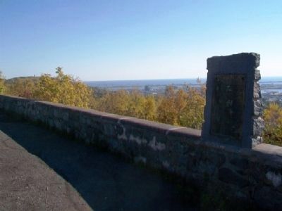
Regarding Oneota. The Lions Club symbol is missing from the top of the marker.
Photographed by William Fischer, Jr., October 11, 2014
3. Oneota Marker
Credits. This page was last revised on February 12, 2023. It was originally submitted on November 8, 2014, by William Fischer, Jr. of Reynoldsburg, Ohio. This page has been viewed 1,179 times since then and 76 times this year. Photos: 1, 2, 3. submitted on November 8, 2014, by William Fischer, Jr. of Reynoldsburg, Ohio.
