Split Rock Lighthouse State Park in Lake County, Minnesota — The American Midwest (Upper Plains)
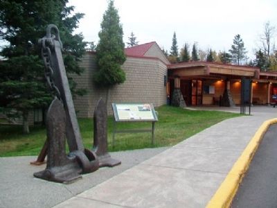
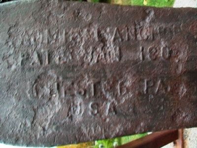
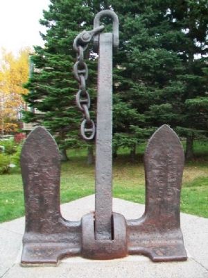
Anchor of the Madeira
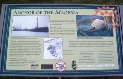
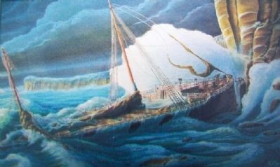
This anchor was salvaged from the shipwreck of the 5000-ton steel barge, Madeira, which was tossed up against Gold Rock Point, about a quarter mile northeast of here, during the fierce storm of November 27-28, 1905. As the ship broke apart on the vertical face of Gold Rock Point, one of her crew, Fred Benson, carrying a coil of rope, leapt to the rock and, in the snow and dark, climbed the 80-foot cliff, secured the rope, and threw it down to the rest of the crew. Nine of her crew of ten men survived by climbing the rope to safety at the cliff top. One man died in the attempt as the ship broke apart and sank.
The storm of the century
The storm of November 27-28, 1905 sank or heavily damaged more than 20 ships on the western end of Lake Superior. Nine ships were wrecked and eleven men were killed along the North Shore.
As the result of this storm the U.S. Congress funded the building of Split Rock Light Station. The lighthouse went into service on July 31, 1910 within a quarter mile of the Madeira shipwreck.
The shipwreck
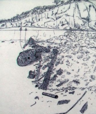
The storm-battered Madeira broke apart and sank in several pieces. In the 1960s a salvage company acquired rights to cut up the wreck for scrap iron. Scuba divers Raymond Peterson and Richard Hewitt purchased the title to the bow anchor that was still on the Madeira.
Working underwater for three weekends, the divers removed the four-ton anchor by hacksawing the heavy chain. The anchor was moved by truck to a dive shop in Brainerd, Minnesota for display. It was later returned to the North Shore where for many years it was displayed outside a gift shop along Highway 61 near Split Rock Lighthouse. In 2010 it was moved to its current location.
The Madeira anchor was donated to the Great Lakes Shipwreck Preservation Society in 2009 by Raymond Peterson, Richard Hewitt and Mrs. Sharon Sheppard. The GLSPS cleaned the anchor, applied a preservation coating, and built the display base. They moved the anchor to its current location on permanent loan to the Minnesota Historical Society.
The Madeira anchor monument was made possible by the donors, the GLSPS, and a 2010 Great Lakes Shipwreck Research Foundation Grant. This interpretive panel was made possible by a Minnesota Historical and Cultural Grant from the Arts and Cultural Heritage Fund through the vote of Minnesotans on November 4, 2008. Administered by the Minnesota Historical Society
[Image captions, from left to right, read]
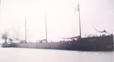
1. Schooner-barge Madeira about 1900-05
Courtesy of Lake Superior Maritime Collection, University of Wisconsin-Superior
2. The Madeira shipwreck on the bottom of Lake Superior, at the base of Gold Rock Point.
Drawing by Stephen B. Daniel
3. Painting of Madeira wrecking on Gold Rock Point, by Kurt Carlson
Courtesy of Great Lakes Shipwreck Historical Society, Whitefish Point, Michigan
Erected by Minnesota Historical Society.
Topics and series. This historical marker is listed in these topic lists: Disasters • Waterways & Vessels. In addition, it is included in the Minnesota Historical Society series list. A significant historical month for this entry is July 1875.
Location. 47° 12.067′ N, 91° 22.016′ W. Marker is in Split Rock Lighthouse State Park, Minnesota, in Lake County. Marker is near the Split Rock Lighthouse visitor center. Touch for map. Marker is at or near this postal address: 3755 Split Rock Lighthouse Road, Two Harbors MN 55616, United States of America. Touch for directions.
Other nearby markers. At least 8 other markers are within walking distance of this marker. Geology of the Split Rock Region (within shouting distance of this marker); Storage Barn (within shouting distance of this marker); Home Away From Home (about 300 feet away, measured in a direct line); Oil House (about 300 feet away); Fog Signal (about 300 feet away); The Gales of November (about 300 feet away); Steam Engine Hoist (about 300 feet away); Lighthouse (about 300 feet away).
Also see . . .
1. The Mataafa Blow: The Stormy Horror of 1905. (Submitted on November 9, 2014, by William Fischer, Jr. of Scranton, Pennsylvania.)
2. November 28, 1905: The Mataafa Storm. (Submitted on November 9, 2014, by William Fischer, Jr. of Scranton, Pennsylvania.)
3. Split Rock Lighthouse State Park MN. (Submitted on November 9, 2014, by William Fischer, Jr. of Scranton, Pennsylvania.)
Additional keywords. Anchor of the Madeira
Credits. This page was last revised on December 10, 2020. It was originally submitted on November 9, 2014, by William Fischer, Jr. of Scranton, Pennsylvania. This page has been viewed 832 times since then and 44 times this year. Photos: 1, 2, 3, 4, 5, 6, 7. submitted on November 9, 2014, by William Fischer, Jr. of Scranton, Pennsylvania.
