Lake Ozark in Camden County, Missouri — The American Midwest (Upper Plains)
Bagnell Dam
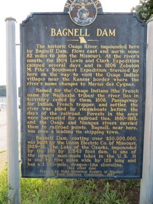
The historic Osage River, impounded here by Bagnell Dam, flows east and north some 82 miles to join the Missouri. At the river's mouth, the 1804 Lewis and Clark Expedition camped several days and in 1806 Zebulon M. Pike's Southwest Expedition traveled by here on the way to visit the Osage Indian villages near the Kansas border where the river's name changes to Marias des Cygnes.
Named for the Osage Indians (the French name for Wazhazhe tribes) the river lies in territory ceded by them, 1808. Passageway for Indian, French trapper, and settler, the river was plied by steamboats, before the days of the railroad. Forests in area were harvested for railroad ties, 1880-1915, and the Osage and Niangua rivers carried them to railroad points. Bagnell, near here, was once a leading tie shipping town.
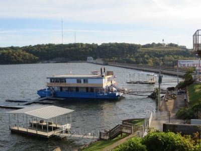
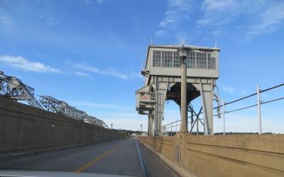
Bagnell Dam, costing over $30,000,000, was built by the Union Electric Co. of Missouri, 1929-31. The Lake of the Ozarks, impounded by the 148 by 2,543 foot dam, is one of the largest man-made lakes in the U.S. It is one to five miles wide by 129 long and has a 1,300-mile dragon-like shoreline.
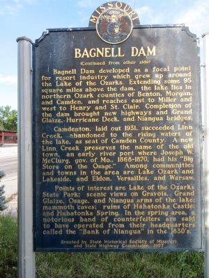
Bagnell Dam developed as a focal point for resort industry which grew up around the Lake of the Ozarks. Extending some 95 square miles above the dam, the lake lies in northern Ozark counties of Benton, Morgan, and Camden, and reaches east to Miller and west to Henry and St. Clair. Completion of the dam brought new highways and Grand Glaize, Hurricane Deck, and Niangua bridges.
Camdenton, laid out 1931, succeeded Linn Creek, abandoned to the rising waters of the lake, as seat of Camden County. A new Linn Creek preserves the name of the old town, an early river port where Joseph W. McClurg, gov, of Mo., 1866-1870, had his “Big Store on the Osage.” among communities and towns in the area are Lake Ozark and Lakeside, and Eldon, Versailles, and Warsaw.
Points of interest are Lake of the Ozarks State Park; scenic views on Gravois, Grand Glaize, Osage, and Niangua arms of the lake; mammoth caves; ruins of the Hahatonka Castle; and Hahatonka Spring. In the spring area, a notorious band of counterfeiters and said to have operated from their headquarters called the “Bank of Niangua” in the 1830's.
Erected 1957 by State Historical Society of Missouri and State Highway Commission.
Topics and series. This historical marker is listed in these topic lists: Exploration • Native Americans • Settlements & Settlers • Waterways & Vessels. In addition, it is included in the Lewis & Clark Expedition, and the Missouri, The State Historical Society of series lists. A significant historical year for this entry is 1804.
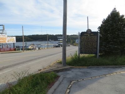
Location. 38° 12.054′ N, 92° 37.801′ W. Marker is in Lake Ozark, Missouri, in Camden County. Marker is on Bagnell Dam Boulevard, on the left when traveling west. Touch for map. Marker is in this post office area: Lake Ozark MO 65049, United States of America. Touch for directions.
Other nearby markers. At least 2 other markers are within 10 miles of this marker, measured as the crow flies. Miller County (approx. 9.3 miles away); Miller County Veterans Memorial (approx. 9.4 miles away).
Credits. This page was last revised on December 10, 2020. It was originally submitted on November 10, 2014, by Bill Kirchner of Tucson, Arizona. This page has been viewed 918 times since then and 52 times this year. Photos: 1, 2, 3, 4, 5. submitted on November 10, 2014, by Bill Kirchner of Tucson, Arizona. • Al Wolf was the editor who published this page.
