Near Omaha in Douglas County, Nebraska — The American Midwest (Upper Plains)
Lewis and Clark Campsite
July 27, 1804
Photographed by Michael James, May 24, 2008
1. Lewis and Clark Campsite: Marker
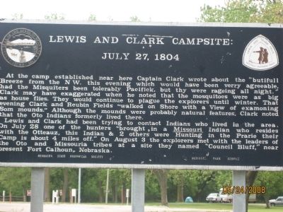
At the camp established very near here Captain Clark wrote about the "butifull Breeze from the N W. this evening which would have been verry agreeable, had the Misquiters been tolerably Pacifick, but thy were rageing all night." Clark may have exaggerated when he noted that the mosquitoes were as big as house flies. They would continue to plague the explorers until winter. That evening Clark and Ruben Fields "walked on Shore with a View of examoning Som mounds." Although the mounds were probably natural features, Clark noted that the Oto Indians formerly lived there.
Lewis and Clark had been trying to contact Indians who lived in the area. On July 28 one of the hunters "brought in a Missouri Indian who resides with the Otteauz, this Indian & 2 others were Hunting in the Prarie their Camp is about 4 miles off." On August 3 the explorers met with the leaders of the Oto and Missouria tribes at a site they named "Council Bluff," near present Fort Calhoun, Nebraska.
Erected by Nebraska State Historical Society; National Park Service, U.S. Department of the Interior. (Marker Number 340.)
Topics and series. This
this page online
Location. 41° 21.513′ N, 95° 57.106′ W. Marker is near Omaha, Nebraska, in Douglas County. It can be reached from Dodge Park Road 0.6 miles east of John J. Pershing Dr.. Located inside NP Dodge Memorial Park. Follow the signs towards the campsite to find the marker. Touch for map. Marker is in this post office area: Omaha NE 68112, United States of America. Touch for directions.

Regionally, this marker is in Eastern Nebraska. It is also in the American Midwest, in the Lewis & Clark Corridor, in the Corn Belt, and on the prairies. Globally, it is in North America, the Western Hemisphere, the Western World, and the Anglosphere. Historically, it finds itself in what was once the Louisiana Purchase.
Other nearby markers. At least 8 other markers are within 2 miles of this marker, measured as the crow flies: Lewis & Clark Expedition 1804-1806 (within shouting distance of this marker); A Satisfying Meeting (approx. 0.4 miles away); Mormon Pioneer Memorial Bridge (approx. one mile away); Fort Lisa (approx. one mile away); John Pierre Cabanne's (approx. one mile away); Crossroads to the West: (approx. 1.2 miles away); The Road to Zion (approx. 1.2 miles away); The Florence Mill (approx. 1.2 miles away). Touch for a list and map of all markers in Omaha.
Credits. This page was last revised on October 21, 2025. It was originally submitted on May 24, 2008, by Michael James of Fort Calhoun, Nebraska. This page has been viewed 2,446 times since then and 67 times this year. Photo 1. submitted on May 24, 2008, by Michael James of Fort Calhoun, Nebraska. • Kevin W. was the editor who published this page.
Editor’s want-list for this marker. Wide angle photograph of the area. • Can you help?
