
Placentia, Newfoundland and Labrador — The Atlantic Provinces (North America)
Castle Hill
Photographed by Barry Swackhamer, June 21, 2014
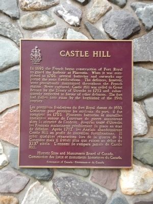
1. Castle Hill Marker

In 1693 the French began construction of Fort Royal to guard the harbour at Placentia. When it was completed in 1703, several batteries and outworks supported the main fortifications. The defences, however, were precariously maintained throughout the French régime. Never captured, Castle Hill was ceded to Great Britain by the Treaty of Utrecht in 1713 and subsequently neglected in favor of other defences. The fort has fallen into ruins by the beginning of the 19th century.
Erected by Historic Sites and Monument Board
this page online
Topics and series. This historical marker is listed in these topic lists: Forts and Castles • War, French and Indian. In addition, it is included in the Canada, Historic Sites and Monuments Board series list. A significant historical year for this entry is 1693.
Location. 47° 15.084′ N, 53° 58.349′ W. Marker is in Placentia, Newfoundland and Labrador. It is on Castle Hill Road close to Route 100 South. Touch for map. Marker is in this post office area: Placentia NL A0B, Canada. Touch for directions.

Regionally, this marker is in Atlantic Canada. Globally, it is in the North Atlantic Region, North America, the Western Hemisphere, the Western World, and the Anglosphere. Historically, it finds itself in what was once a British colony and also the Viceroyalty of New France.
Other nearby markers. At least 5 other markers are within walking distance of this marker: A different marker also named Castle Hill (a few steps from this marker); Fort Royal (Plaisance) (within shouting distance of this marker); Port Royal and Castle Graves / Port Royal et Castle Graves
Photographed by Barry Swackhamer, June 21, 2014
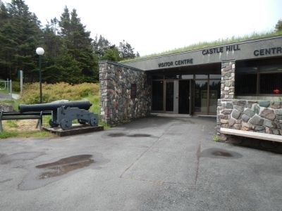
2. Castle Hill Marker
More about this marker. Castle Hill National Historic Site is located at the end of Castle Hill Road,
Also see . . . Castle Hill, Newfoundland and Labrador - Wikipedia. Castle Hill is an area containing the remains of both French and British fortifications, overlooking the town of Placentia (français: Plaisance) in Newfoundland and Labrador, Canada. The site was originally established in order to protect the French fishing interests in Newfoundland and the approaches to the French colony of Canada. (Submitted on November 15, 2014, by Barry Swackhamer of Brentwood, California.)
Photographed by Barry Swackhamer, June 21, 2014
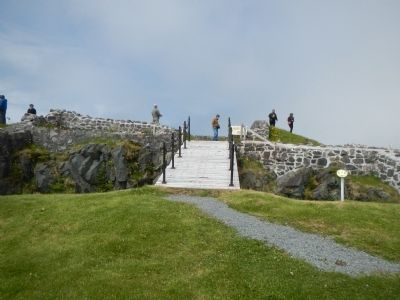
3. Fort Royal ruins
Photographed by Barry Swackhamer, June 21, 2014
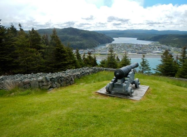
4. The town of Placentia from Castle Hill
Credits. This page was last revised on September 3, 2026. It was originally submitted on November 15, 2014, by Barry Swackhamer of Brentwood, California. This page has been viewed 650 times since then and 36 times this year. Photos: 1, 2, 3, 4. submitted on November 15, 2014, by Barry Swackhamer of Brentwood, California. • Andrew Ruppenstein was the editor who published this page.
