St. John's in CensusDiv 1 - Avalon Peninsula-St. John's, Newfoundland and Labrador — The Atlantic Provinces (North America)
Battle of Signal Hill
⎯⎯⎯
La bataille de Signal Hill
Photographed by Barry Swackhamer, June 22, 2014
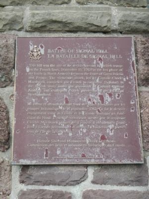
1. Battle of Signal Hill Marker

This hill was the site of the decisive assault by British troops on the French lines, September 15, 1762, in the last phase of the battle in North America between the forces of Great Britain and France. The victorious attack, led by Captain Charles Macdonell, compelled the French to surrender St. John’s to the British army under command of Colonel William Amherst and confirmed British possession the Island of Newfoundland.
Erected 1961 by Historic Sites and Monument Board of Canada/Commission de lieux et monuments historique du Canada.
Topics and series. This historical marker is listed in this topic list: War, French and Indian. In addition, it is included in the Canada, Historic Sites and Monuments Board series list. A significant historical date for this entry is September 15, 1901.
Location. 47° 34.203′ N,
this page online

Regionally, this marker is on the Avalon Peninsula. It is also in Atlantic Canada. Globally, it is in the North Atlantic Region, North America, the Western Hemisphere, the Western World, and the Anglosphere. Historically, it finds itself in what was once a British colony and also the Viceroyalty of New France.
Other nearby markers. At least 8 other markers are within walking distance of this marker: Cabot Tower (here, next to this marker); Peacetime Use (a few steps from this marker); Noon Day Gun (a few steps from this marker); Fishery (a few steps from this marker); Swiling (within shouting distance of this marker); Ice (within shouting distance of this marker); 1892: The Great Fire (within shouting distance of this marker); Transatlantic Radio Signals (within shouting distance of this marker). Touch for a list and map of all markers in St. John's.
More about this marker.
Photographed by Barry Swackhamer, June 22, 2014
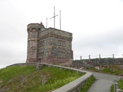
2. Battle of Signal Hill Marker
The marker is mounted on the closest corner of Cabot Tower in this view.
Regarding Battle of Signal Hill / La bataille de Signal Hill. The Battle of Signal Hill was the last battle in North America of the Seven Years War, or the French and Indian War as is known in the United States.
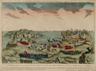
Also see . . . Battle of Signal Hill. On September 13, 1762, the British landed at Torbay, a few miles to the north. Ternay and Haussonville were unable to counter it, so to hamper the British advance, they dispatched a detachment to guard the bare summit of Signal Hill. (Submitted on November 16, 2014, by Barry Swackhamer of Brentwood, California.)
Photographed by Unknown, n.d.
3. Battle of Signal Hill, a contemporary French engraving
Credits. This page was last revised on December 21, 2025. It was originally submitted on November 16, 2014, by Barry Swackhamer of Brentwood, California. This page has been viewed 1,844 times since then and 111 times this year. Photos: 1, 2, 3. submitted on November 16, 2014, by Barry Swackhamer of Brentwood, California. • Andrew Ruppenstein was the editor who published this page.
