Perth Amboy in Middlesex County, New Jersey — The American Northeast (Mid-Atlantic)
Perth Amboy
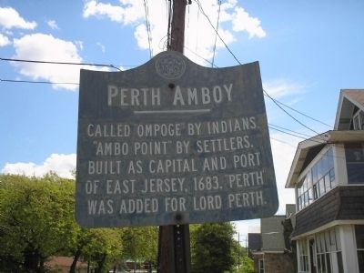
Photographed by Bill Coughlin, May 24, 2008
1. Perth Amboy Marker
Erected by State of New Jersey.
Topics. This historical marker is listed in this topic list: Colonial Era. A significant historical year for this entry is 1683.
Location. 40° 31.333′ N, 74° 17.285′ W. Marker is in Perth Amboy, New Jersey, in Middlesex County. It is on New Brunswick Avenue, on the right when traveling east. Touch for map. Marker is at or near this postal address: 700 New Brunswick Avenue, Perth Amboy NJ 08861, United States of America. Touch for directions.

Regionally, this marker is in New Jersey’s Central Jersey, in Greater Princeton, and in the New York City Metropolitan Area. It is also in the American Northeast, in the Mid-Atlantic, and on the Eastern Seaboard. Globally, it is in the North Atlantic Region, North America, the Western Hemisphere, the Western World, and the Anglosphere. Historically, it finds itself in what was once New Netherland and also one of the original Thirteen Colonies.
Other nearby markers. At
this page online
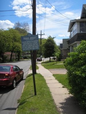
Photographed by Bill Coughlin, May 24, 2008
2. Marker on New Brunswick Avenue
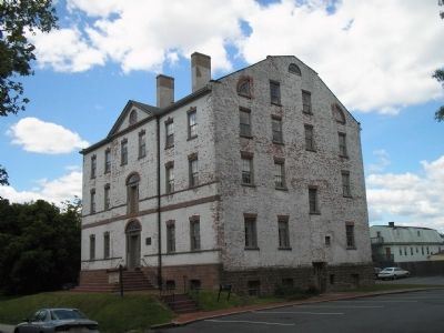
Photographed by Bill Coughlin, May 24, 2008
3. The Proprietary House
Perth Amboy is home to the Proprietary House, home of William Franklin, son of Benjamin Franklin and the last Royal Governor of New Jersey.
Credits. This page was last revised on June 16, 2016. It was originally submitted on May 24, 2008, by Bill Coughlin of Woodland Park, New Jersey. This page has been viewed 1,520 times since then and 32 times this year. Photos: 1, 2, 3. submitted on May 24, 2008, by Bill Coughlin of Woodland Park, New Jersey.
