Marker Logo HMdb.org THE HISTORICAL
MARKER DATABASE
“Bite-Size Bits of Local, National, and Global History”
Stafford in Stafford County, Virginia — The American South (Mid-Atlantic)
 

Mt. Hope Baptist Church


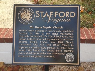
Mt. Hope Baptist Church Marker image. Click for full size.
Photographed By Kevin W., November 4, 2014
1. Mt. Hope Baptist Church Marker
Inscription. Sunday School gathered in 1877. Church established October 16,1880 by Rev. Natus Washington. Originally worshipped at St. John School House near Brooke. Pickle Factory building nearer to church later became Brooke School. May 1904 Church cornerstone laid. First area ethnic church to implement worship every Sunday. 15 Pastors have served. 10th Pastor, Rev. Edward Smith, educator, civic and civil rights leader, was instrumental in the local integration movement.
 
Erected 2014 by Stafford County.
 
Topics. This historical marker is listed in these topic lists: African AmericansChurches & ReligionCivil Rights. A significant historical year for this entry is 1877.
 
Location. 38° 23.067′ N, 77° 23.106′ W. Marker is in Stafford, Virginia, in Stafford County. Marker is on Susies Lane just east of Mount Hope Church Road (County Route 677). Touch for map. Marker is at or near this postal address: 1653 Brooke Road, Stafford VA 22554, United States of America. Touch for directions.
 
Other nearby markers. At least 8 other markers are within 2 miles of this marker, measured as the crow flies. Union Army Winter Camp Remains (approx. 1.1 miles away); Union Infantry Winter Camp (approx. 1.2 miles away); Eleventh Corps Encampment Area (approx. 1.2 miles away); Potomac Church Road (approx. 1.2 miles away); Union Batteries at Accokeek Creek
Paid Advertisement
Click on the ad for more information.
Please report objectionable advertising to the Editor.
Click or scan to see
this page online
(approx. 1.2 miles away); Union Eleventh Corps Artillery (approx. 1.2 miles away); Quarrying the Stone (approx. 1.2 miles away); Sandstone Quarry (approx. 1.2 miles away). Touch for a list and map of all markers in Stafford.
 
Also see . . .  Mt. Hope Baptist Church website. (Submitted on November 21, 2014, by Kevin W. of Stafford, Virginia.)
 
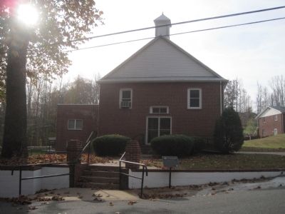
Mt. Hope Baptist Church and Marker image. Click for full size.
Photographed By Kevin W., November 4, 2014
2. Mt. Hope Baptist Church and Marker
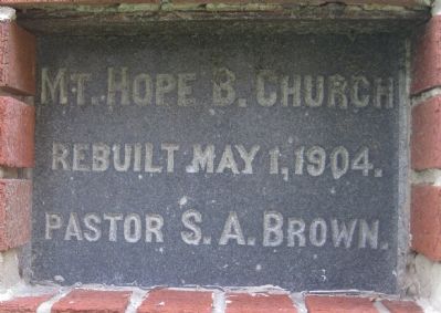
Mt. Hope Baptist Church Cornerstone image. Click for full size.
Photographed By Kevin W., November 4, 2014
3. Mt. Hope Baptist Church Cornerstone
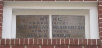
Window above the entrance doors of Mt. Hope Baptist Church image. Click for full size.
Photographed By Kevin W., November 4, 2014
4. Window above the entrance doors of Mt. Hope Baptist Church
 
 
Credits. This page was last revised on June 16, 2016. It was originally submitted on November 21, 2014, by Kevin W. of Stafford, Virginia. This page has been viewed 459 times since then and 13 times this year. Photos:   1, 2, 3, 4. submitted on November 21, 2014, by Kevin W. of Stafford, Virginia.
Share this page.  
Share on Tumblr
m=79035

CeraNet Cloud Computing sponsors the Historical Marker Database.
This website earns income from purchases you make after using our links to Amazon.com. We appreciate your support.
Paid Advertisement
Apr. 19, 2024