Near Barnesville in Belmont County, Ohio — The American Midwest (Great Lakes)
Captina African Methodist Episcopal Cemetery
Photographed by Mike Wintermantel, November 29, 2014
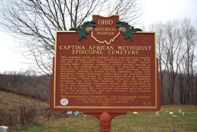
1. Captina African Methodist Episcopal Cemetery Marker
Erected 2002 by Ohio Bicentennial Commission, The Longaberger Company, The Dean Martin Committee, and The Ohio Historical Society. (Marker Number 8-7.)
Topics and series. This historical marker is listed in these topic lists: Abolition & Underground RR
this page online
Location. 39° 56.326′ N, 81° 8.799′ W. Marker is near Barnesville, Ohio, in Belmont County. It is on Oakes Place 0.2 miles Flat Rock Road, on the right when traveling south. Touch for map. Marker is in this post office area: Barnesville OH 43713, United States of America. Touch for directions.

Regionally, this marker is in Ohio’s High Valley. It is also in the American Midwest, in Appalachia, and specifically in Northern Appalachia. Globally, it is in North America, the Western Hemisphere, the Western World, and the Anglosphere. Historically, it finds itself in what was once the Haudenosaunee (Iroquois) Confederacy, the territory of the Mississippian Culture, and the Northwest Territory.
Other nearby markers. At least 8 other markers are within 4 miles of this marker, measured as the crow flies: American Legion Post 168 Veterans Memorial (approx.
Photographed by Mike Wintermantel, November 29, 2014
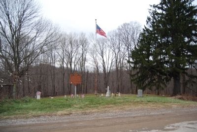
2. Captina African Methodist Episcopal Cemetery Marker
Photographed by Mike Wintermantel, November 29, 2014
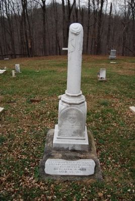
3. Captina African Methodist Episcopal Cemetery
Alexander Harper Grave
Photographed by Mike Wintermantel, November 29, 2014
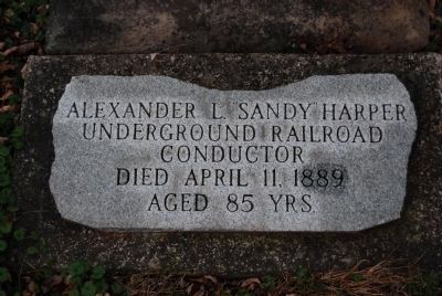
4. Captina African Methodist Episcopal Cemetery
Descriptor Stone at base of Alexander Harper's grave
Alexander L. "Sandy" Harper
Underground Railroad Conductor
Died April 11, 1889
Aged 85 years
Alexander L. "Sandy" Harper
Underground Railroad Conductor
Died April 11, 1889
Aged 85 years
Photographed by Mike Wintermantel, November 29, 2014
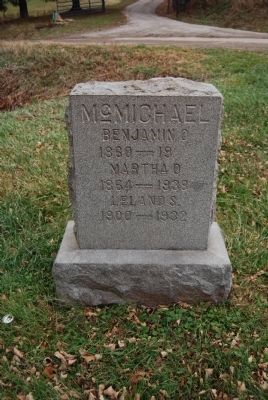
5. Captina African Methodist Episcopal Cemetery
Benjamin Oliver McMichael Grave
Credits. This page was last revised on June 16, 2016. It was originally submitted on November 29, 2014, by Mike Wintermantel of Pittsburgh, Pennsylvania. This page has been viewed 1,922 times since then and 63 times this year. Photos: 1, 2, 3, 4, 5. submitted on November 29, 2014, by Mike Wintermantel of Pittsburgh, Pennsylvania.
