Bridgeport in Morrill County, Nebraska — The American Midwest (Upper Plains)
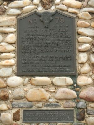
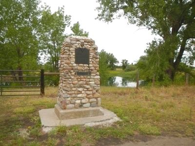
Mormon Pioneer Camp
The Mormon Trail was on the north side of the river and the Oregon Trail on the south side.
Erected 1938 by Morrill County, Nebraska, Historical Society, Oregon Trail Memorial Association & Utah Pioneer Trails and Landmarks Association. (Marker Number 79.)
Topics and series. This historical marker is listed in these topic lists: Roads & Vehicles • Settlements & Settlers. In addition, it is included in the Mormon Pioneer Trail, and the Utah Pioneer Trails and Landmarks Association series lists. A significant historical date for this entry is May 24, 1847.
Location. 41° 40.779′ N, 103° 5.75′ W. Marker is in Bridgeport, Nebraska, in Morrill County. Marker is on Main Street (Route 26/385) near Brown's Creek Road (underpass), on the left when traveling north. Touch for map. Marker is in this post office area: Bridgeport NE 69336, United States of America. Touch for directions.
Other nearby markers. At least 8 other markers are within 6 miles of this marker, measured as the crow flies. Bridgeport, Nebraska (approx. half a mile away); Dedicated to the Early Pioneers (approx. 1.1 miles away); Oregon Trail (approx. 1.7 miles away); Guiding Landmarks (approx. 2.2 miles away); Dedicated to the Unknown Soldier (approx. 2.7 miles away); a different marker also named Oregon Trail (approx. 2.7 miles away); Camp Clarke Bridge and Sidney-Black Hills Trail (approx. 3.8 miles away); Courthouse and Jail Rocks (approx. 5˝ miles away). Touch for a list and map of all markers in Bridgeport.
Additional keywords. Mormon Trail
Credits. This page was last revised on June 16, 2016. It was originally submitted on December 5, 2014, by Barry Swackhamer of Brentwood, California. This page has been viewed 691 times since then and 22 times this year. Photos: 1, 2. submitted on December 5, 2014, by Barry Swackhamer of Brentwood, California. • Bill Pfingsten was the editor who published this page.

