
Near L'Anse-au-Loup in CensusDiv 10 - Labrador-Happy Valley-Goose Bay, Newfoundland and Labrador — The Atlantic Provinces (North America)
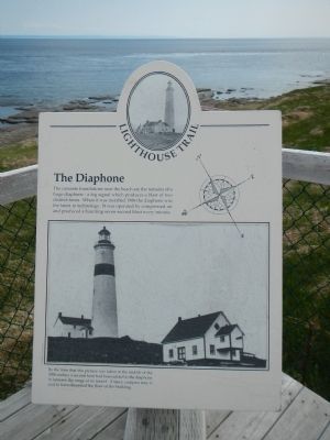
The Diaphone
Lighthouse Trail
Photographed by Barry Swackhamer, June 27, 2014
1. The Diaphone Marker
Topics and series. This historical marker is listed in these topic lists: Communications • Waterways & Vessels. In addition, it is included in the Lighthouses series list. A significant historical year for this entry is 1906.
Location. 51° 27.631′ N, 56° 51.47′ W. Marker is near L'Anse-au-Loup, Newfoundland and Labrador, in CensusDiv 10 - Labrador-Happy Valley-Goose Bay. It can be reached from L'Anse Amour Branch Road close to Trans-Labrador Highway (Newfoundland and Labrador Route 510), on the right when traveling east. Touch for map. Marker is in this post office area: L'Anse-au-Loup NL A0K 3L0, Canada. Touch for directions.

Regionally, this marker is in Atlantic Canada. Globally, it is in the North Atlantic Region, North America, the Western Hemisphere, the Western World, and the Anglosphere. Historically,
this page online
Other nearby markers. At least 4 other markers are within 21 kilometers of this marker, measured as the crow flies: The Marconi Station (within shouting distance of this marker); L’Anse Amour Burial (approx. 2.2 kilometers away); L'anse Amour (approx. 2.3 kilometers away); Thrombolites or Living Rocks (approx. 20.3 kilometers away).
More about this marker. This maker is located at the Point Amour Lighthouse at the Straits of Belle Isle overlook.
Also see . . .
1. Archaeocyatha. The remains of Archaeocyatha are mostly preserved as carbonate structures in a limestone matrix. This means that the fossils cannot be chemically or mechanically isolated, save for some specimens that have already eroded out of their matrices, and their morphology has to be determined from thin cuts of the stone in which they were preserved. (Submitted on December 9, 2014, by Barry Swackhamer of Brentwood, California.)
2. Point Amour Lighthouse - Labrador Coastal Drive. At 109 feet from the ground to the light itself, Point Amour lighthouse is the tallest in Atlantic Canada and the second tallest lighthouse ever built in Canada. It is still a working lighthouse that is now automated of course. The lighthouse tower and surrounding buildings have been designated a Provincial Historic Site. .i (Submitted on December 9, 2014, by Barry Swackhamer of Brentwood, California.)
Photographed by Barry Swackhamer, June 27, 2014
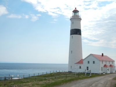
2. The Point Amour Lighthouse
The marker is located at the overlook on the left.
Photographed by Barry Swackhamer, June 27, 2014
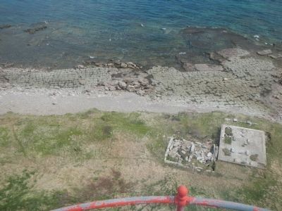
3. The Diaphone foundation, view from the lighthouse
Note the unusual pattern on the beach, its a patch reef.
Photographed by Barry Swackhamer, June 27, 2014
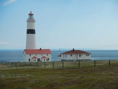
4. Point Amour Lighthouse
Photographed by Barry Swackhamer, June 27, 2014
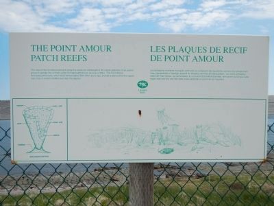
5. The Point Amour Patch Reefs / Les plaques de recif de Point Amour
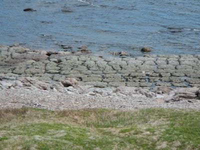
The mound-like formations present along this shore are composed of the calcite skeletons of an extinct group of sponge-like animals called Archaeocyathids (arc-ae-o-sy-a thids). The Point Amour Arcaeocyathid reefs, which we formed 530 million years ago, provide evidence that this region was once in a warm shallow sea near the equator.
French:
Les formations arrondies le long de cette cote composent des squelettes calcifies d’un groupe d’animaux resemblant a l’éponge, aujourd’hui disparus nommes archaeocyatides. Les récifs archaeocyatides de Point Amour, qui se formèrent il y a environs 530 million d’années témoignent du fait que cette region était une fois un mer tièdes et peu profonde en proximité de l’équateur.
French:
Les formations arrondies le long de cette cote composent des squelettes calcifies d’un groupe d’animaux resemblant a l’éponge, aujourd’hui disparus nommes archaeocyatides. Les récifs archaeocyatides de Point Amour, qui se formèrent il y a environs 530 million d’années témoignent du fait que cette region était une fois un mer tièdes et peu profonde en proximité de l’équateur.
Photographed by Barry Swackhamer, June 27, 2014
6. The Point Amour Patch Reefs / Les plaques de recif de Point Amour
Credits. This page was last revised on February 10, 2020. It was originally submitted on December 9, 2014, by Barry Swackhamer of Brentwood, California. This page has been viewed 654 times since then and 19 times this year. Photos: 1, 2, 3, 4, 5, 6. submitted on December 9, 2014, by Barry Swackhamer of Brentwood, California. • Andrew Ruppenstein was the editor who published this page.
