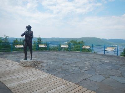
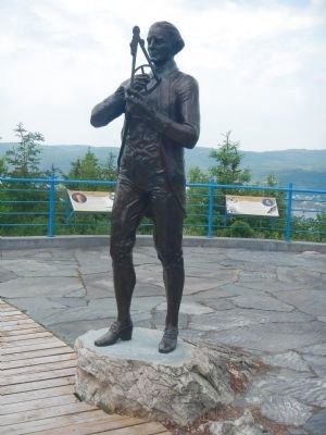
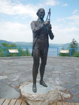
Corner Brook in Humber Valley, Newfoundland, Newfoundland and Labrador — The Atlantic Provinces (North America)
Cook comes to Canada
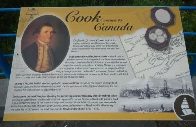
Captain James Cook took his first voyage to Canada as a Master on the vessel ”Pembroke” in February 1785. The British forces were embroiled in the Seven Years War with the French.
Cook arrived in Halifax, Nova Scotia and took part in the blockade of Louisburg (sic) which the French surrendered that July. It was here, that Cook had an encounter that would begin his transformation from a Sailing Master to a renowned cartographer and surveyor. Cook observed an engineer officer using a strange device on the beach. The man was Samuel Holland, an army surveyor-engineer and the device was a plane table. In the months to come, Holland would teach Cook how to survey and make charts as well as the use of the plane table.
In May 1759, the British started up the St. Lawrence River to capture the French stronghold of Quebec. Cook and Holland were tasked with the dangerous and difficult job of charting the river. Quebec fell to the British in September 1759.
Cook spent the next few years honing his surveying and cartography skills in Halifax before joining an offensive on the French, who had captured St. John’s, Newfoundland with plans to hold it as a bargaining chip, in the post war negotiations with Great Britain. St. John’s was successfully taken from the French. The next year Cook was selected to return to Newfoundland to survey the area. He would spend the next five years in Newfoundland from 1763 - 1767.
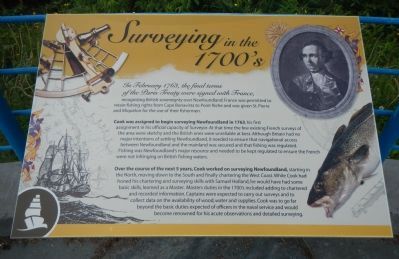
In February 1763, the final terms of the Paris Treaty were signed with France, recognizing British sovereignty over Newfoundland. France was permitted to retain fishing rights from Cape Bonavista to Port Riche and was given St. Pierre and Miquelon for the use of their fishermen.
Cook was assigned to begin surveying Newfoundland in 1763, his first assignment in his official capacity of Surveyor. At that time the few existing French surveys of the area were sketchy and the British ones were unreliable at best. Although Britain had no major intentions of settling Newfoundland, it needed to ensure that navigational access between Newfoundland and the mainland was secured and that fishing was regulated. Fishing was Newfoundland’s major resource and needed to be kept regulated to ensure the French were not infringing on the British fishing waters.
Over the course of the next 5 years, Cook worked on surveying Newfoundland, starting in the North, moving down to the South and finally chartering the West Coast. While Cook had honed his chartering and surveying skills with Samuel Holland, he would have had some basic skills, learned as a Master. Masters duties in the 1700s included adding to chartered and recorded information. Captains were expected to carry out surveys and to collect data on the availability of wood, water and supplies. Cook was to go far beyond the basic duties expected of officiers in the naval service and would become renowned for his acute observations and detailed surveying.
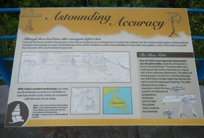
Although there had been other surveyors before him, Cook was the first to establish the precision of the land survey process as an integral part of coastal chart making. Over the warmer months spent in Newfouldland, Cook kept astonishingly accurate and detailed logs of the coastal conditions as well as the availability of wood, water and supplies. Cook’s charts were so accurate that they were still in use hundreds of years later.
The Plane Table (side-bar on right)
One of Cook’s most important instruments was the plane table, originally introduced to him by Samuel Holland. The plane table was a small, square, flat surface mounted on a tripod with a brass telescope attachment. The table has drawing paper secured on it, and the telescope was fitted with a straight edge that allowed the user to mark the telescope’s
Photographed By Barry Swackhamer, July 1, 2014
3. Astounding Accuracy panel
Caption: With today’s modern technology, our maps are all extremely accurate. it is incredible to note how similar Cook’s charts are compared with the ones we use today.; Above - Cook’s chart of Western Newfoundland.; Right - A Chart of Newfoundland and Labrador as recorded by Cook and later Lane who also chartered parts of Newfoundland.; Far right - A modern version of Newfoundland’s coastline.
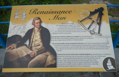
Cook was truly a renaissance man of his times. Cook’s hunger for knowledge and his aptitude for all things scientific meant he was consistently acquiring new skills and honing his existing ones. Cook was able seaman, surveyor, navigator and even astronomer.
Cook demonstrated his abilities as a seaman by commanding the Grenville safely around Newfoundland’s rocky coastline and undertook many safe voyages between Britain and Newfoundland.
His surveying skills set the standard for the times and in fact he improved the methods of surveying in his day. Whilst in Newfoundland he produced four extraordinarily accurate charts. It is interesting to note that although Cook was assigned to survey Newfoundland by the British Government, he had to pay for the printing and and engraving of his charts himself.
Towards the end of Cook’s time in Newfoundland he started to take an interest in astronomy. Cook observed and recorded an eclipse of the sun in the Burgeo Islands - quite possibly Eclipse Island (a small island off the coast of Burgeo). Cook’s observation of the eclipse brought him to attention of the Royal Society for Improving Natural Knowledge (a prominent scientific society in Britain at that time),a fact that would have great implications in coming years.
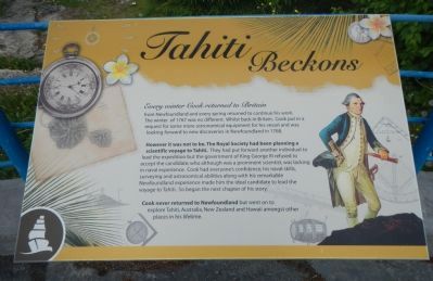
Every winter Cook returned to Britain from Newfoundland and every spring returned to continue his work. The winter of 1767 was no different. Whilst back in Britain, Cook put in a request for more astronomical equipment for his vessel and was looking forward to new discoveries in Newfoundland in 1768.
However it was not to be. The Royal Society had been planning scientific voyage to Tahiti. They had put forward another individual to lead the expedition but the government of King George III refused to accept the candidate; who although a prominent scientist was lacking in naval experience. Cook had everyone’s confidence; his naval skills, surveying and astronomical abilities along with his remarkable Newfoundland experience made him the ideal candidate to lead the voyage to Tahiti. So began the next chapter on his story.
Cook never returned to Newfoundland but went on to explore Tahiti, Australia, New Zealand and Hawaii amongst other places in his lifetime.
Topics. This historical marker is listed in these topic lists: Exploration • Science & Medicine. A significant historical month for this entry is February 1785.
Location. 48° 57.266′ N, 57° 57.775′ W. Marker is in Corner Brook, Newfoundland and Labrador, in Humber Valley, Newfoundland. Marker can be reached from Mayfair Avenue. Touch for map. Marker is in this post office area: Corner Brook NL A2H, Canada. Touch for directions.
Other nearby markers. At least 1 other marker is within walking distance of this marker. Captain James Cook, R.N. (a few steps from this marker).
More about this marker. These plaques are located at the Crow Hill overlook at the north (upper) end of Mayfair Avenue.
Credits. This page was last revised on January 23, 2022. It was originally submitted on December 15, 2014, by Barry Swackhamer of Brentwood, California. This page has been viewed 455 times since then and 24 times this year. Photos: 1, 2, 3, 4, 5, 6, 7, 8. submitted on December 15, 2014, by Barry Swackhamer of Brentwood, California. • Andrew Ruppenstein was the editor who published this page.
