Near Lingle in Goshen County, Wyoming — The American West (Mountains)
Oregon Trail
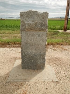
Photographed by Barry Swackhamer, August 22, 2014
1. Oregon Trail Marker
Marked by the
State of Wyoming
1914
Erected 1914 by State of Wyoming.
Topics and series. This historical marker is listed in these topic lists: Roads & Vehicles • Settlements & Settlers. In addition, it is included in the Oregon Trail series list. A significant historical year for this entry is 1914.
Location. 42° 7.93′ N, 104° 24.478′ W. Marker is near Lingle, Wyoming, in Goshen County. It is on State Highway 157 near Road 27, on the left when traveling west. Touch for map. Marker is in this post office area: Lingle WY 82223, United States of America. Touch for directions.

Regionally, this marker is in Wyoming’s Laramie Basin and in the Westward Expansion Trails Region. It is also in the American Mountain West, on the Great Plains, and specifically on the High Plains. Globally, it is in North America, the Western Hemisphere, the Western World, and the Anglosphere. Historically, it finds itself in what was once the Louisiana Purchase.
Other nearby markers. At least 8 other markers are within 9 miles of this marker, measured as the crow flies: To All Pioneers (here, next
this page online
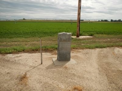
Photographed by Barry Swackhamer, August 22, 2014
2. Oregon Trail Marker
Credits. This page was last revised on June 16, 2016. It was originally submitted on December 19, 2014, by Barry Swackhamer of Brentwood, California. This page has been viewed 745 times since then and 33 times this year. Photos: 1, 2. submitted on December 19, 2014, by Barry Swackhamer of Brentwood, California. • Andrew Ruppenstein was the editor who published this page.
