Fair Haven in Cayuga County, New York — The American Northeast (Mid-Atlantic)
Little Sodus Bay (Fair Haven)
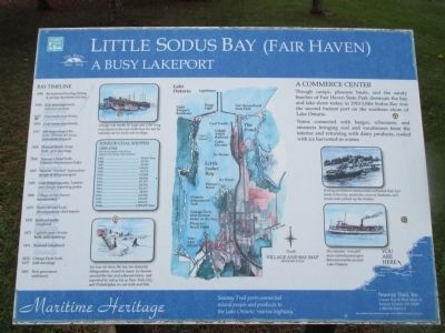
A Busy Lakeport
— Maritime Heritage —
A Commerce Center.
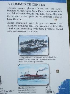
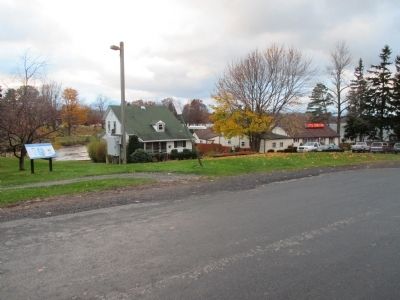
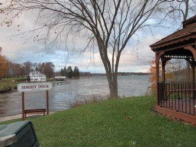
Though camps, pleasure boats, and the sandy beaches of Fair Haven State Park dominate the bay and lake shore today, in 1910 Little Sodus Bay was the second busiest port on the southern shore of Lake Ontario.
Trains connected with barges, schooners, and steamers bringing coal and vacationers from the interior and returning dairy products, cooled with ice harvested in winter.
During prohibition rumrunners unloaded their fast boats in the bay, under cover of darkness, and trucks later picked up the bottles.
The steamer 'Arundell' once carried passengers between resorts around Lake Ontario.
Ice was cut from the bay for domestic refrigeration, stored in many ice houses around the bay and adjacent farms, and exported by rail as far as New York City and Philadelphia to cool milk and fish.
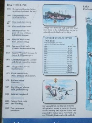
A huge coal trestle 30' high and 1500' long once stood at the end of the bay for use by railroad cars to load coal on ships.
Tons of Coal Shipped 1905-1918.
From books kept by John Brown, Agent for the Lehigh Valley Railroad.
1905.....94,665 Tons; 1906.....933,793; 1907.....95,789; 1908....139,820; 1909.....95,719; 1910....103,509; 1911....108,243; 1912....111,371; 1912....114,932; 1914....121,073; 1915.....40,930; 1916....147,588; 1917....147,625; 1918....145,013; Total..1,567,070 Tons
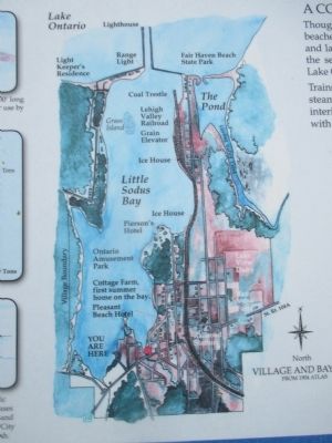
Village and Bay Map from 1904 atlas.
Bay Timeline
1998 Recreational boating-fishing & sailing-dominates the bay.
1938 Last passenger train, railroad era ends.
1937 Coal trestle torn down.
1930 Coal trestle abandoned
1917 568 ships cleared the port. 138 tons of Ciscos (whitefish) shipped.
1908 Pleasant Beach Hotel Built. (still standing)
1898 Pearson's Hotel built. (Ontario Amusement Park)
1897 Steamer 'Arundell' licensed for freight & 800 passengers.
1891 Coal shipping peaks. Lumber and shingle importing peaks.
1880 Village of Fair Haven incorporated.
1879 Grain elevator built. Wood products chief import.
1878 Railroad trestle completed.
1873 Light Keeper's house built. (still standing)
1835-1837 Cottage Farm built. (still standing)
1805 First permanent settlement.
Seaway Trail ports connected inland people and products to the Lake Ontario 'marine highway.'
Seaway Trail, Inc., Corner Ray & West Main St., Sackets Harbor, NY 13685, 1-800-SEAWAY-T. This exhibit made possible by a grant from FHWA to Seaway Trail, Inc.
Erected by Seaway Trail, Inc.
Topics and series. This historical marker is listed in these topic lists: Industry & Commerce • Railroads & Streetcars • Waterways & Vessels. In addition, it is included in the Great Lakes Seaway Trail National Scenic Byway series list. A significant historical year for this entry is 1910.
Location. 43° 18.955′ N, 76° 42.378′ W. Marker is in Fair Haven, New York, in Cayuga County. Marker is on Bell Avenue, 0.1 miles north of Main Street (New York State Route 104A). Touch for map. Marker is at or near this postal address: 7 Bell Avenue, Fair Haven NY 13064, United States of America. Touch for directions.
Other nearby markers. At least 8 other markers are within 4 miles of this marker, measured as the crow flies. Site of Methodist Episcopal Church (about 300 feet away, measured in a direct line); Honoring All Men and Women (about 600 feet away); George E. Ingersol (about 600 feet away); District School # 5 (approx. 3 miles away); School House Built 1825 (approx. 3 miles away); Town of Sterling (approx. 3.1 miles away); Railway Signal Tower (approx. 3.1 miles away); Site of First Baptist Church of Sterling (approx. 3.2 miles away). Touch for a list and map of all markers in Fair Haven.
Credits. This page was last revised on June 16, 2016. It was originally submitted on December 19, 2014, by Anton Schwarzmueller of Wilson, New York. This page has been viewed 1,034 times since then and 62 times this year. Photos: 1, 2, 3, 4, 5, 6, 7. submitted on December 19, 2014, by Anton Schwarzmueller of Wilson, New York. • Bill Pfingsten was the editor who published this page.
