Nebraska City-Fort Kearny Cut-Off
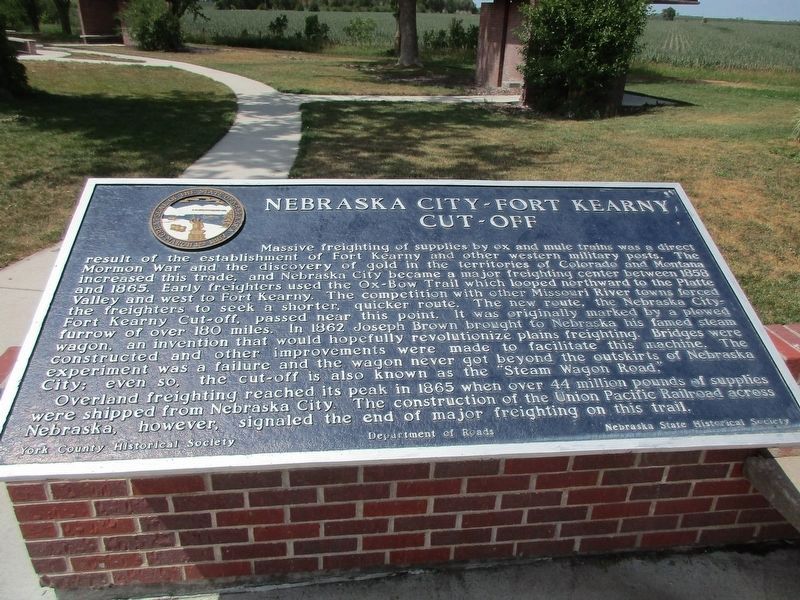
Massive freighting of supplies by ox and mule trains was a direct result of the establishment of Fort Kearny and other western military posts. The Mormon War and the discovery of gold in the territories of Colorado and Montana increased this trade, and Nebraska City became a major freighting center between 1858 and 1865. Early freighters used the Ox-Bow Trail which looped northward to the Platte Valley and west to Fort Kearny. The competition with other Missouri River Towns forced the freighters to seek a shorter, quicker route. The new route, the Nebraska City-Fort Kearny Cut-off, passed near this point. It was originally marked by a plowed furrow of over 180 miles. In 1862 Joseph Brown brought to Nebraska his famed steam wagon, an invention that would hopefully revolutionize plains freighting. Bridges were constructed and other improvements were made to facilitate this machine. The experiment was a failure and the wagon never got beyond the outskirts of Nebraska City; even so, the cut-off is also known as the "Steam Wagon Road."
Overland freighting reached its peak in 1865 when over 44 million pounds of supplies were
this page online
Erected by Nebraska State Historical Society, Department of Roads, and York County Historical Society. (Marker Number 174.)
Topics and series. This historical marker is listed in these topic lists: Industry & Commerce • Roads & Vehicles. In addition, it is included in the Nebraska State Historical Society, and the Oregon Trail series lists. A significant historical year for this entry is 1858.
Location. 40° 49.366′ N, 97° 33.428′ W. Marker is near York, Nebraska, in York County. It is on Interstate 80 at milepost 355.2, on the right when traveling west. Touch for map. Marker is at or near this postal address: Westbound I-80 Rest Area, York NE 68467, United States of America. Touch for directions.

Regionally, this marker is in Eastern Nebraska. It is also in the American Midwest, in the Corn Belt, and on the prairies. Globally, it is in North America, the Western Hemisphere, the Western World, and the Anglosphere. Historically, it finds itself in what was once the
Other nearby markers. At least 8 other markers are within 5 miles of this marker, measured as the crow flies: Nebraska's I-80 Bicentennial Sculptures (here, next to this marker); Moving People and Goods on the Overland Trail (here, next to this marker); The Purple Heart (a few steps from this marker); Nebraska City Cut-Off of the Oregon Trail (approx. 3.2 miles away); York County Veterans Memorial (approx. 3.6 miles away); a different marker also named Nebraska City-Fort Kearny Cut-Off (approx. 4½ miles away); Indians of Nebraska (approx. 4½ miles away); Nebraska 4-H Clubs Began in York County (approx. 4.6 miles away). Touch for a list and map of all markers in York.
Related marker. Click here for another marker that is related to this marker.
Also see . . . Nebraska City-Fort Kearney Cut-Off. Digging In: The Historic Trails of Nebraska website entry (Submitted on December 21, 2014, by William Fischer, Jr. of Reynoldsburg, Ohio.)
Credits. This page was last revised on December 9, 2024. It was originally submitted on December 21, 2014, by William Fischer, Jr. of Reynoldsburg, Ohio. This page has been viewed 1,207 times since then and 64 times this year. Photos: 1. submitted on July 9, 2023, by Jeff Leichsenring of Garland, Texas. 2, 3. submitted on December 21, 2014, by William Fischer, Jr. of Reynoldsburg, Ohio.
